
Property Aerials
Through high-resolution aerials and custom maps, Graphikar showcases properties with clarity and impact. From drone perspectives to branded layouts, these visuals highlight boundaries, access points, and surroundings, helping brokers and investors make better decisions.
Property Aerials
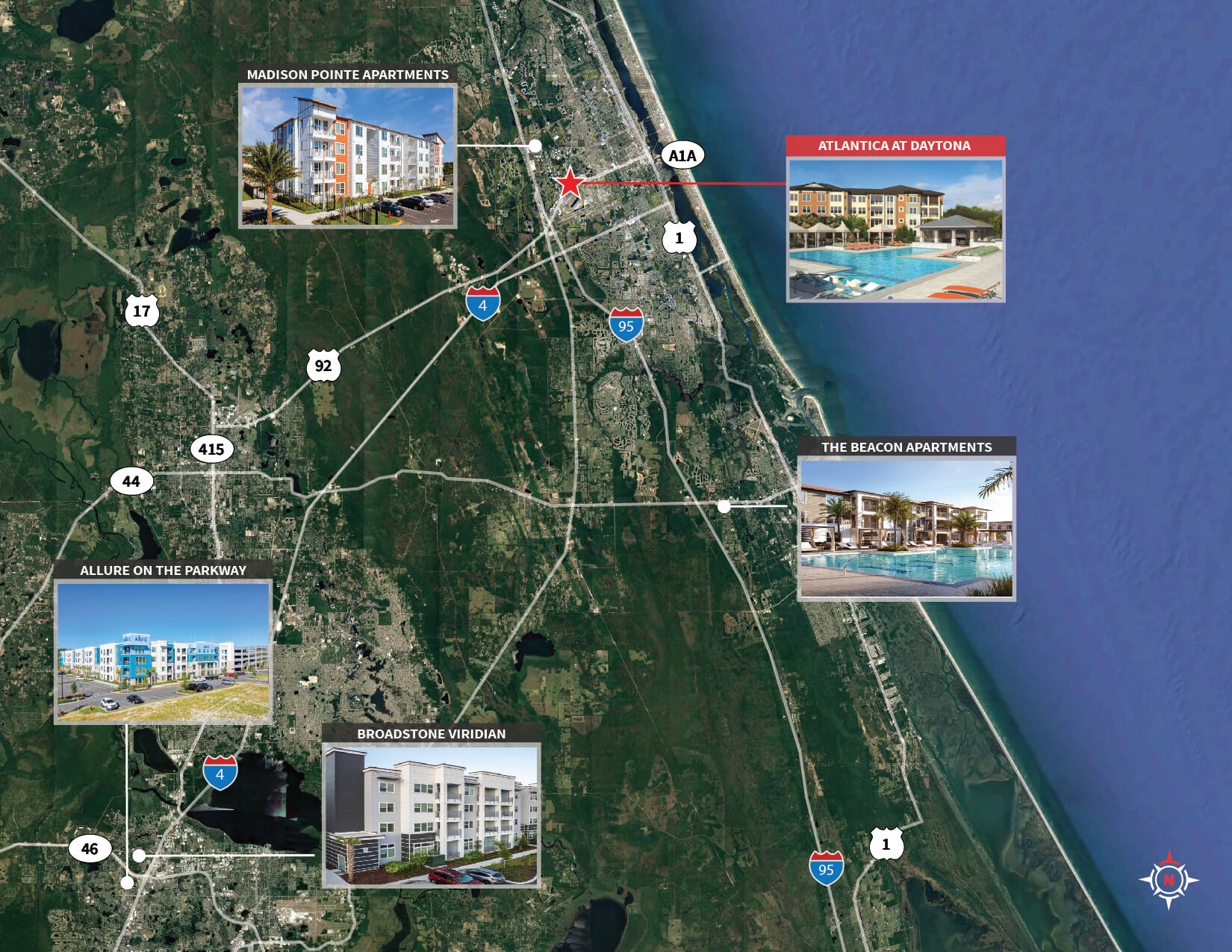
Atlantica Daytona – Sales Comp-01
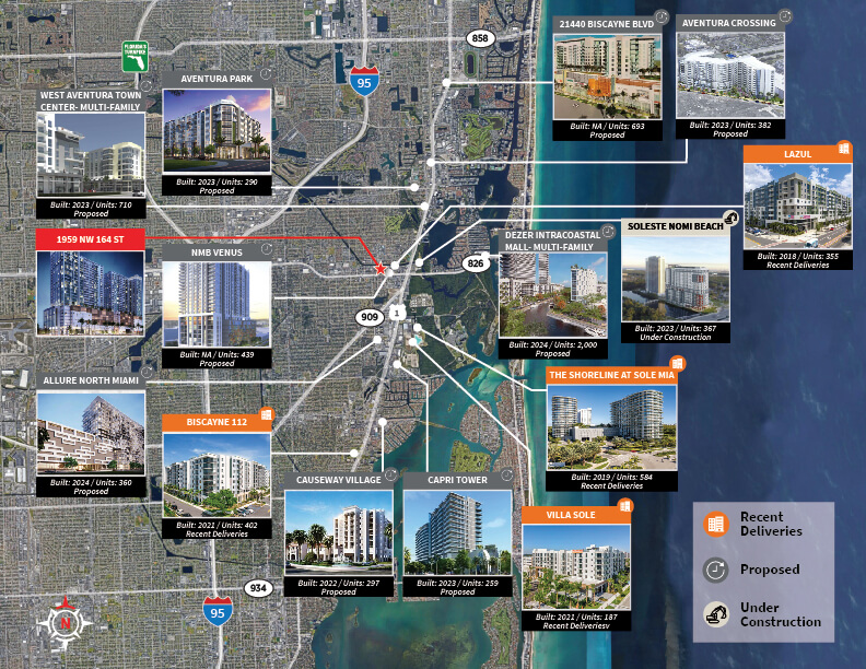
North Miami Beach MF Development-01
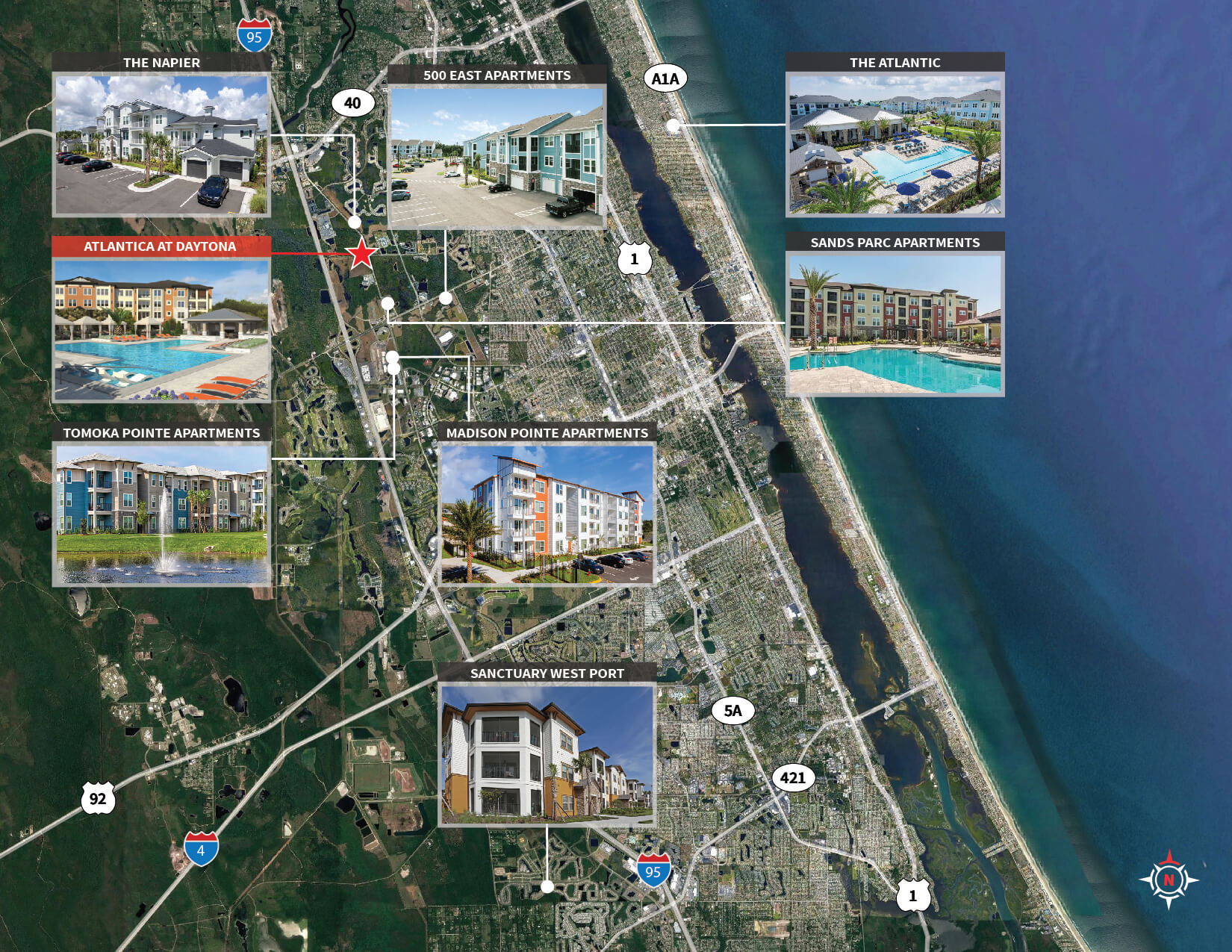
Atlantica Daytona – Rent Comps-01
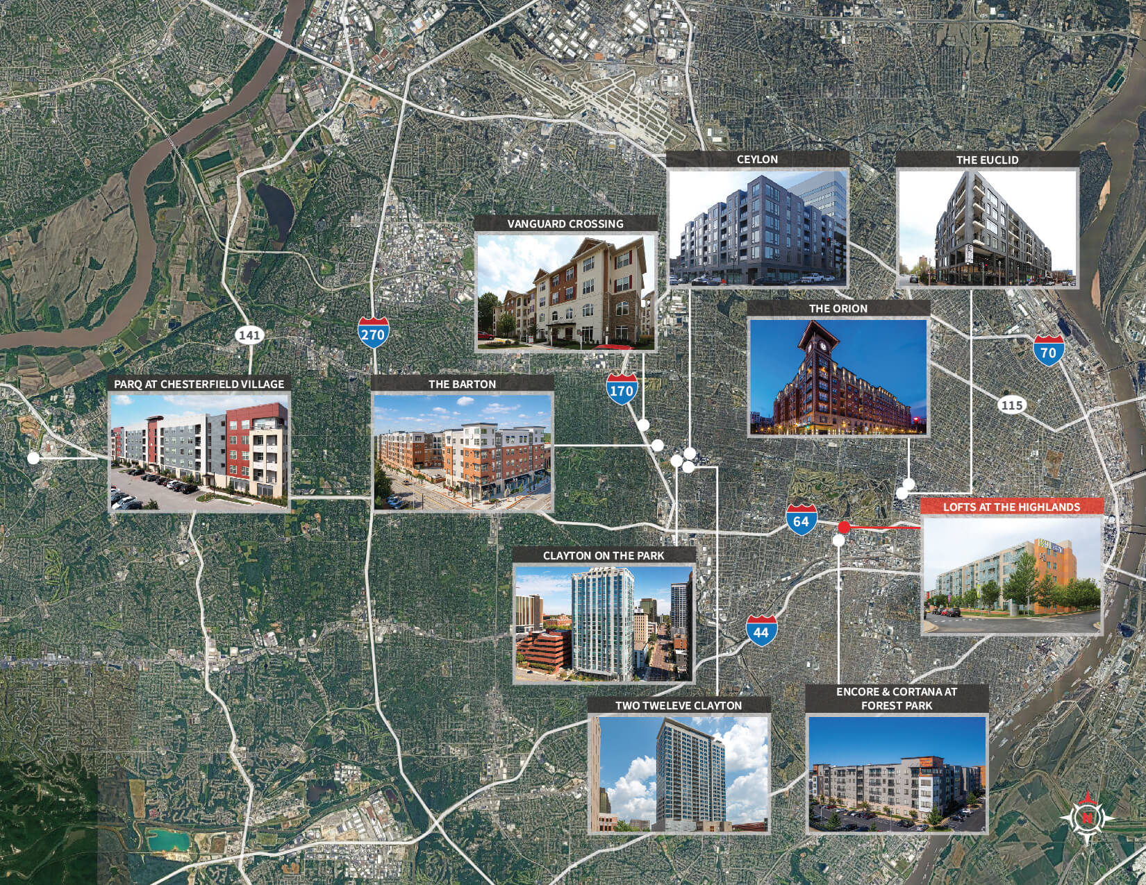
Lofts at the Highlands – Sales Comps-01
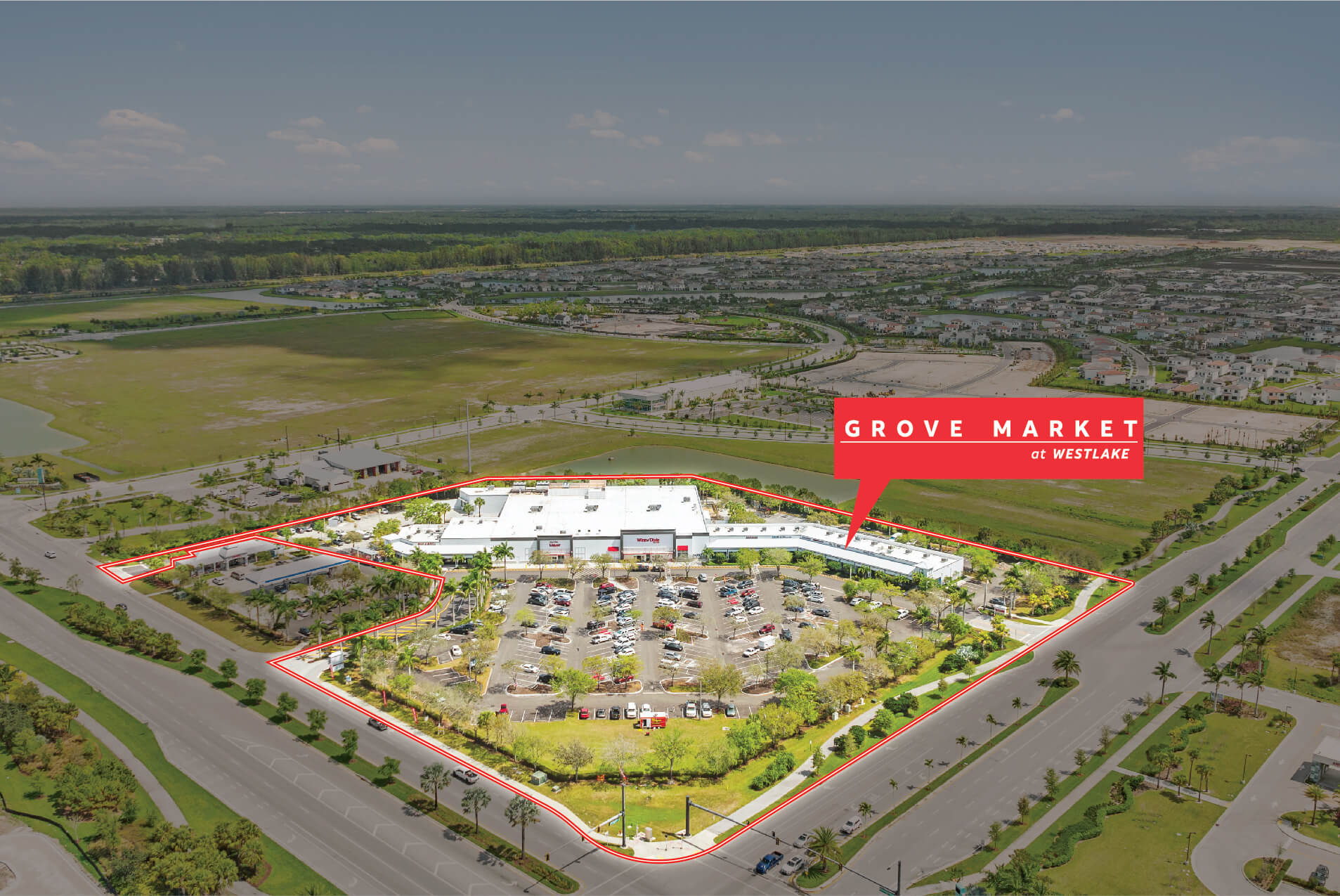
Grove Market Drone Shot-01
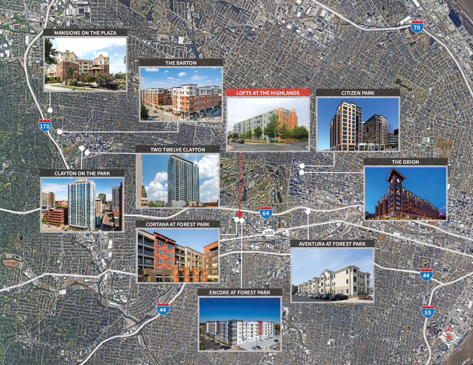
Lofts at the Highlands – Rent Comps-01
Location Maps
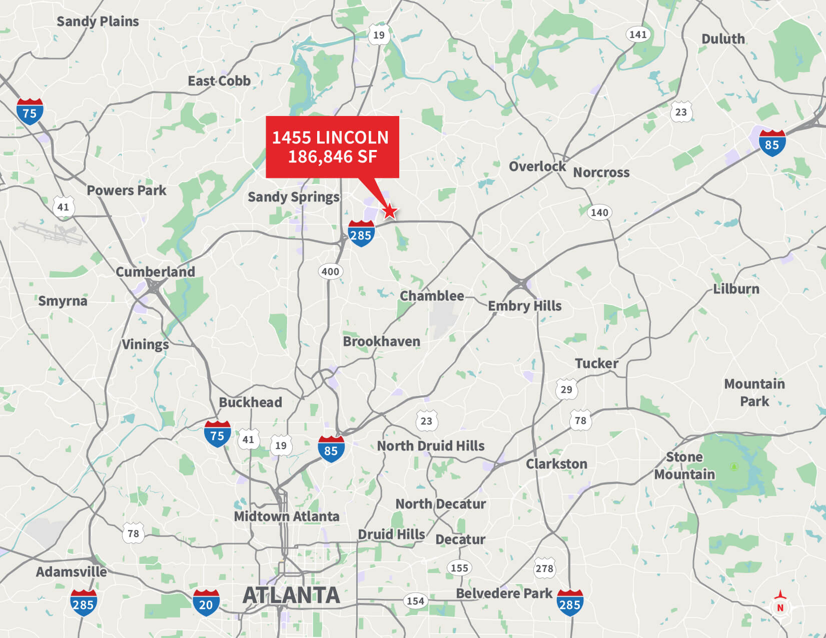
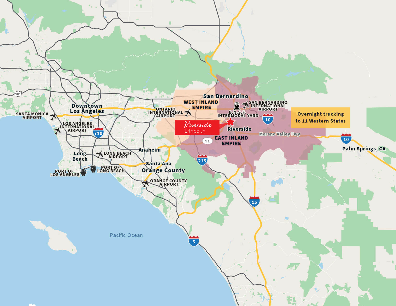
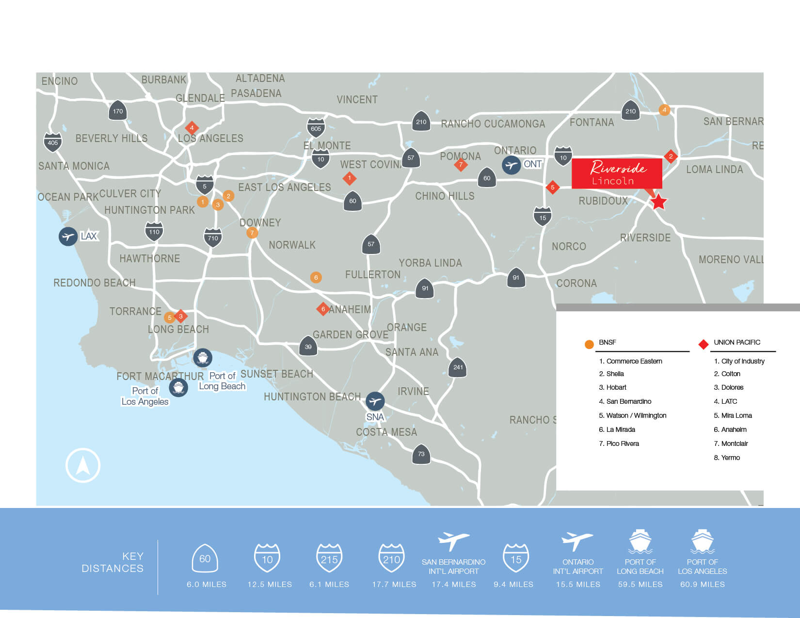
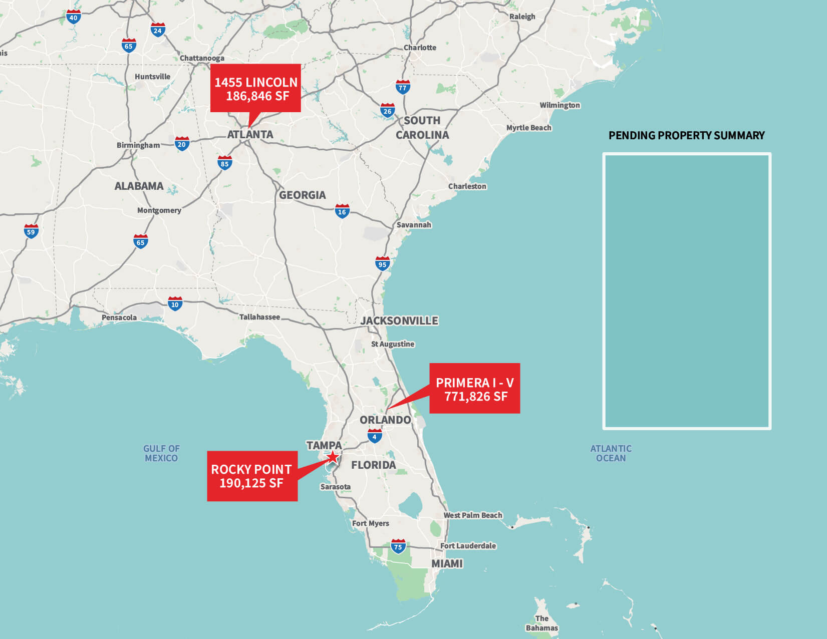
Rocky Pointe Center – 1455 Lincoln_Mapboard
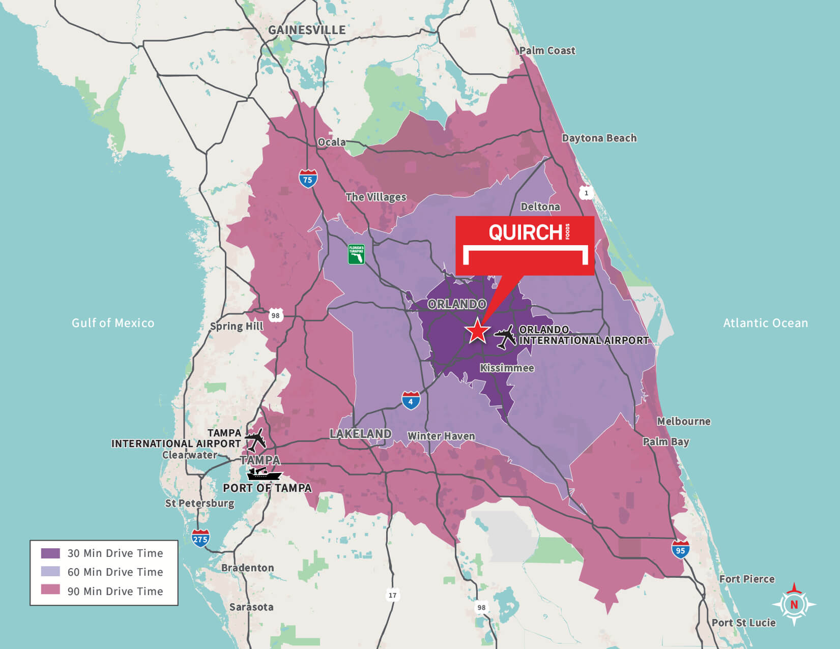
Quirch – Drive Time Map_Mapboard
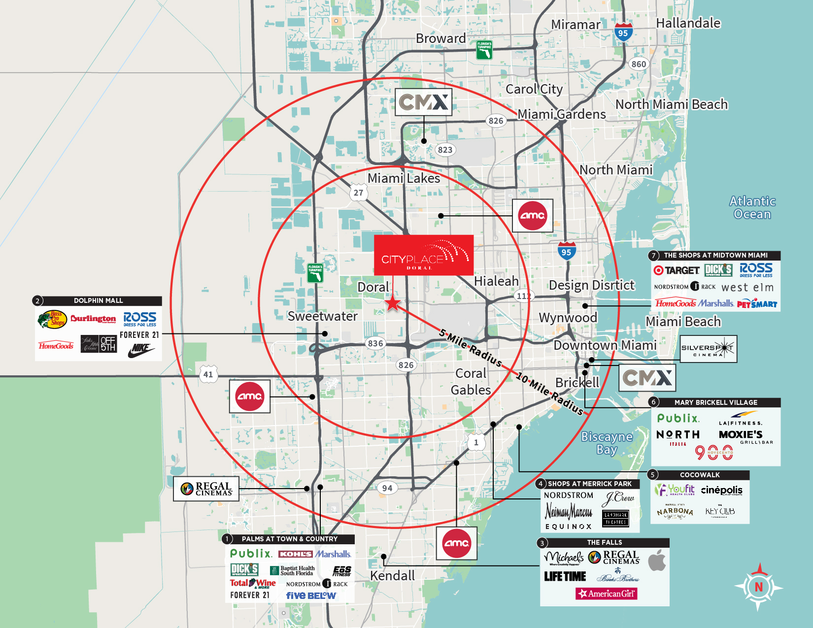
Doral CityPlace Vector Map
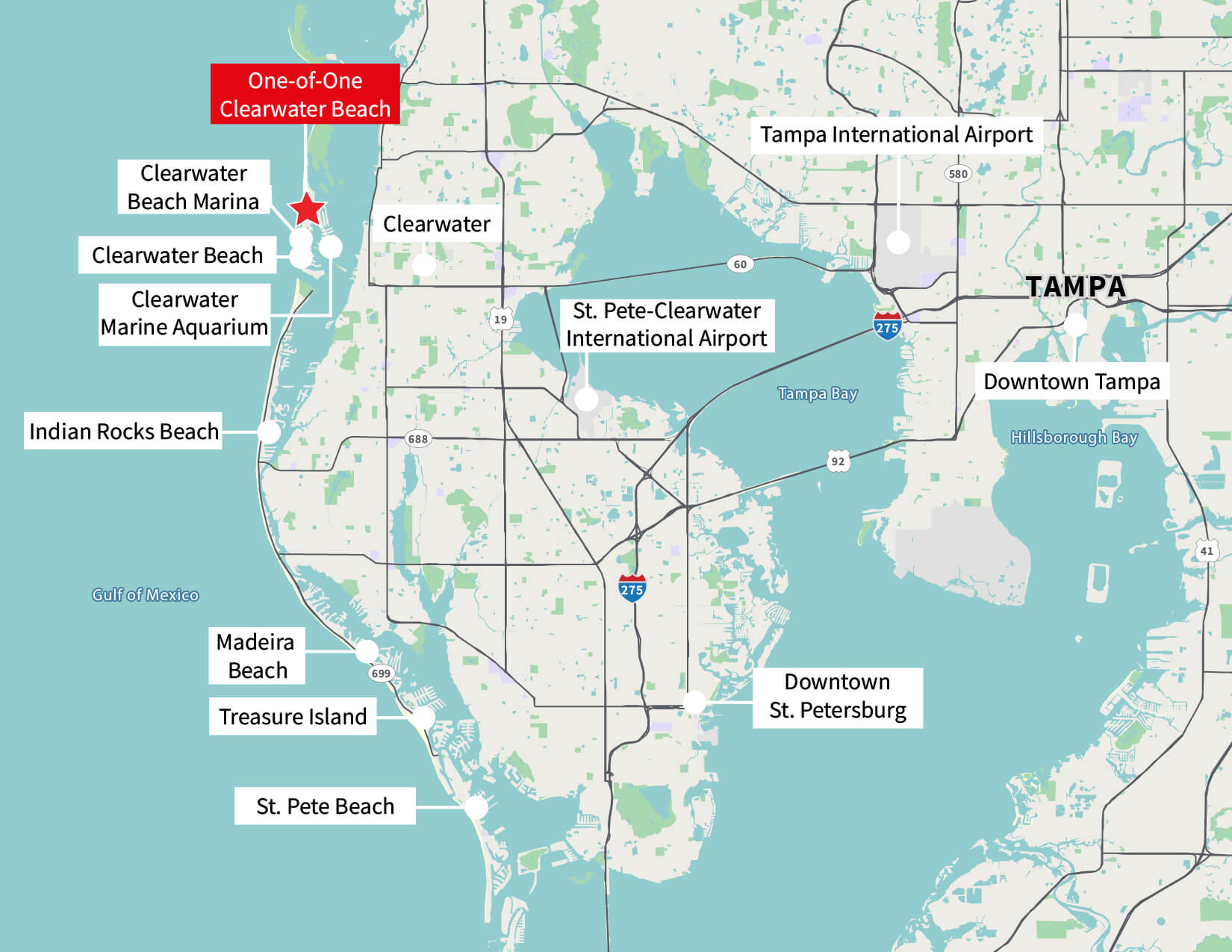
Tampa Area_Mapboard
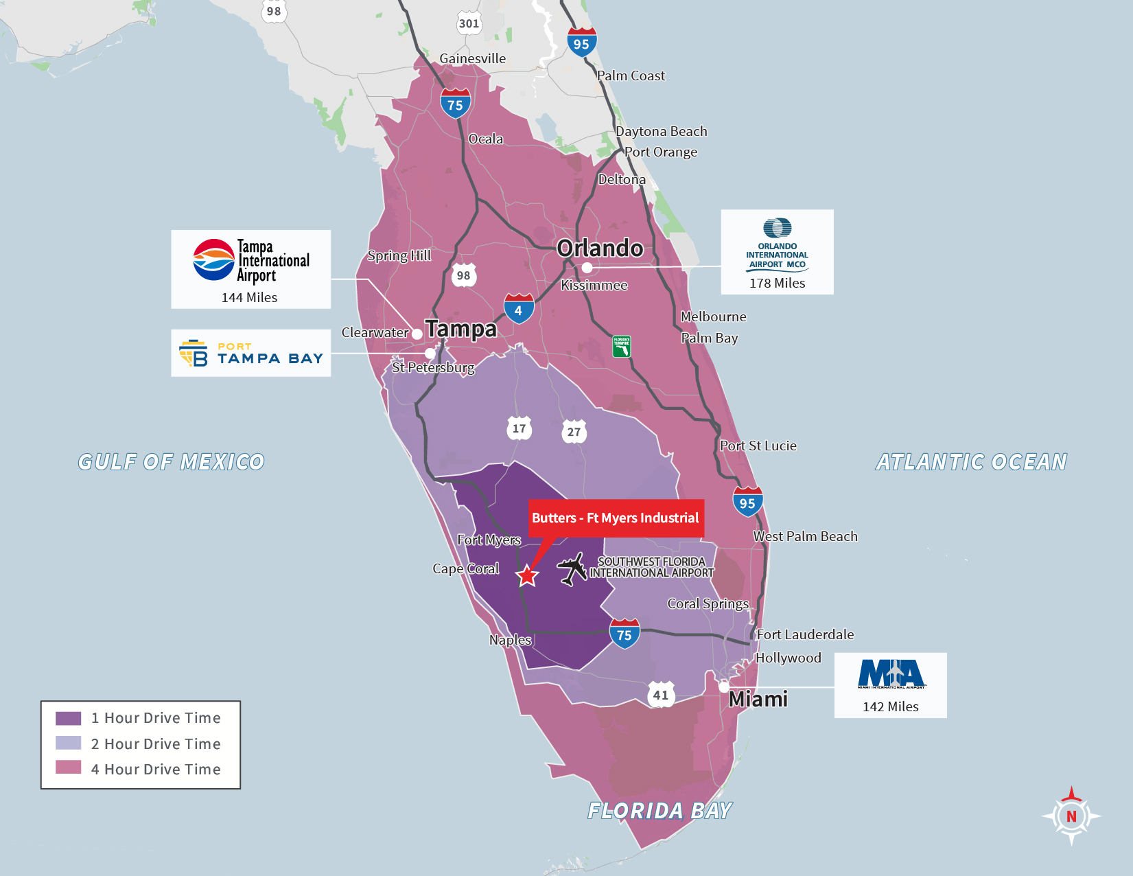
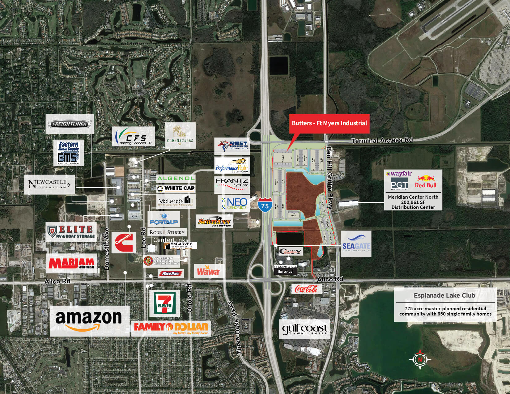
Butters – Ft Myers Industrial – Florida Vector_Mapboard
Butters – Ft Myers Industrial – Florida Vector
Butters – Ft Myers Industrial – Florida Vector
Location Mapv2_Mapboard
Regional Map-01
Butters – Ft Myers Industrial – Florida
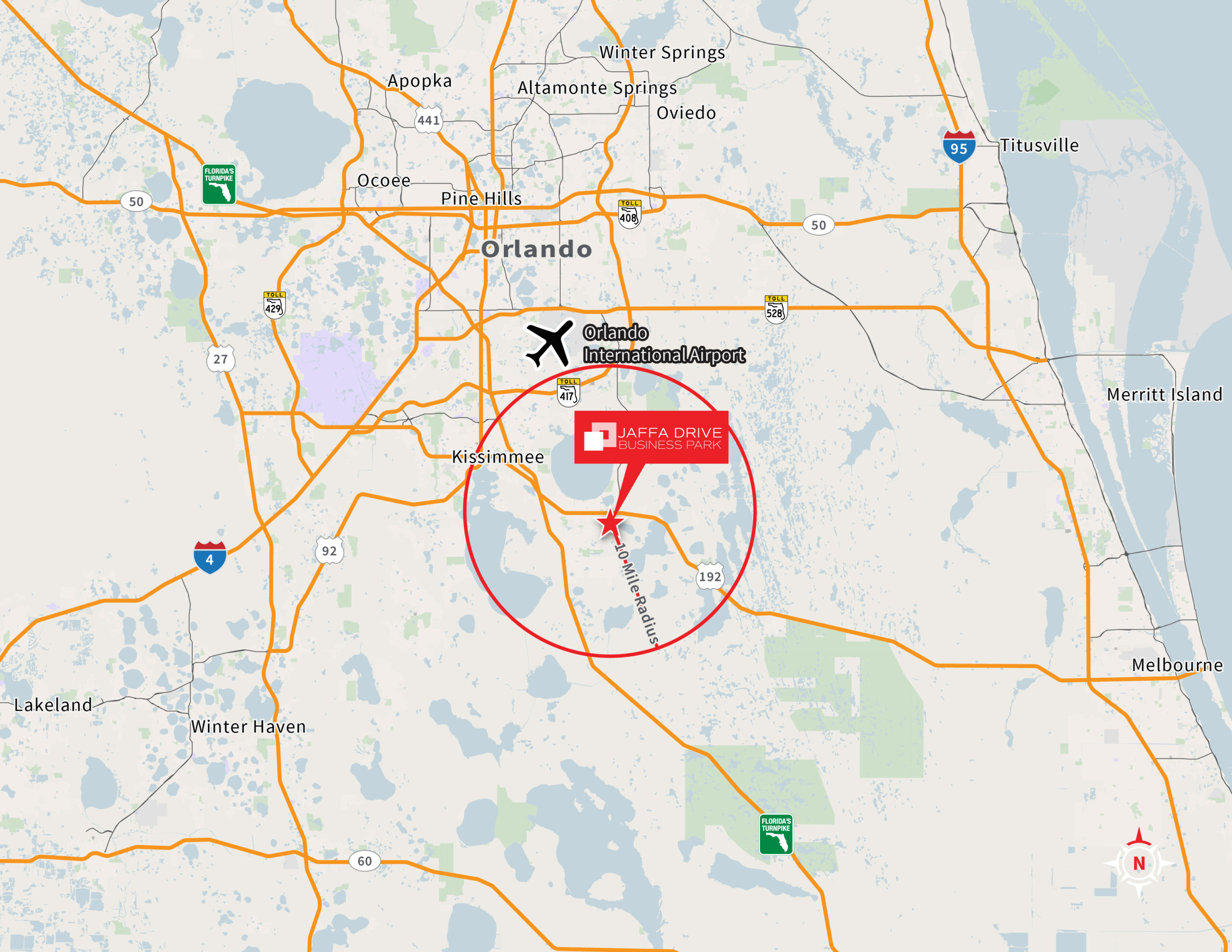
Jaffa Drive Business Park – Regional Vector Map
Biscayne 112 – New Vector Map and Call Out with Logo_Mapboard
Rocky Point Center – Elevation Map
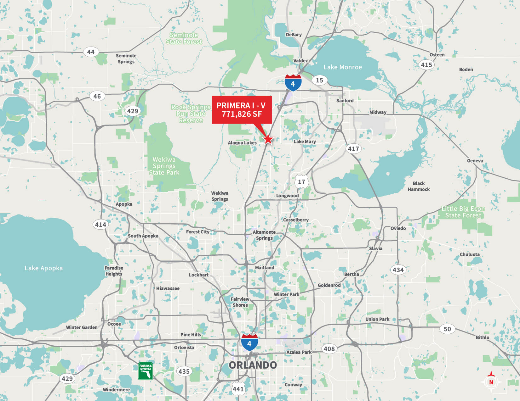
Rocky Pointe Center – Primera Towers I – V-01
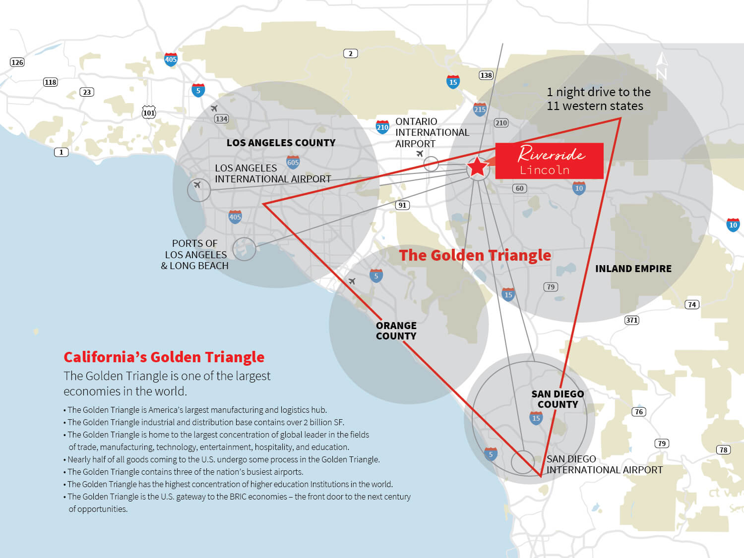
Los Angeles-San Diego Regional Map 1 horz-01
Large/Retail Aerial
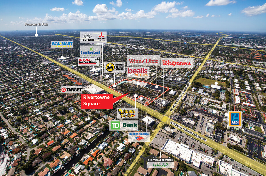
Rivertowne Square – Aerial2
Rivertowne Square Trade Aerial
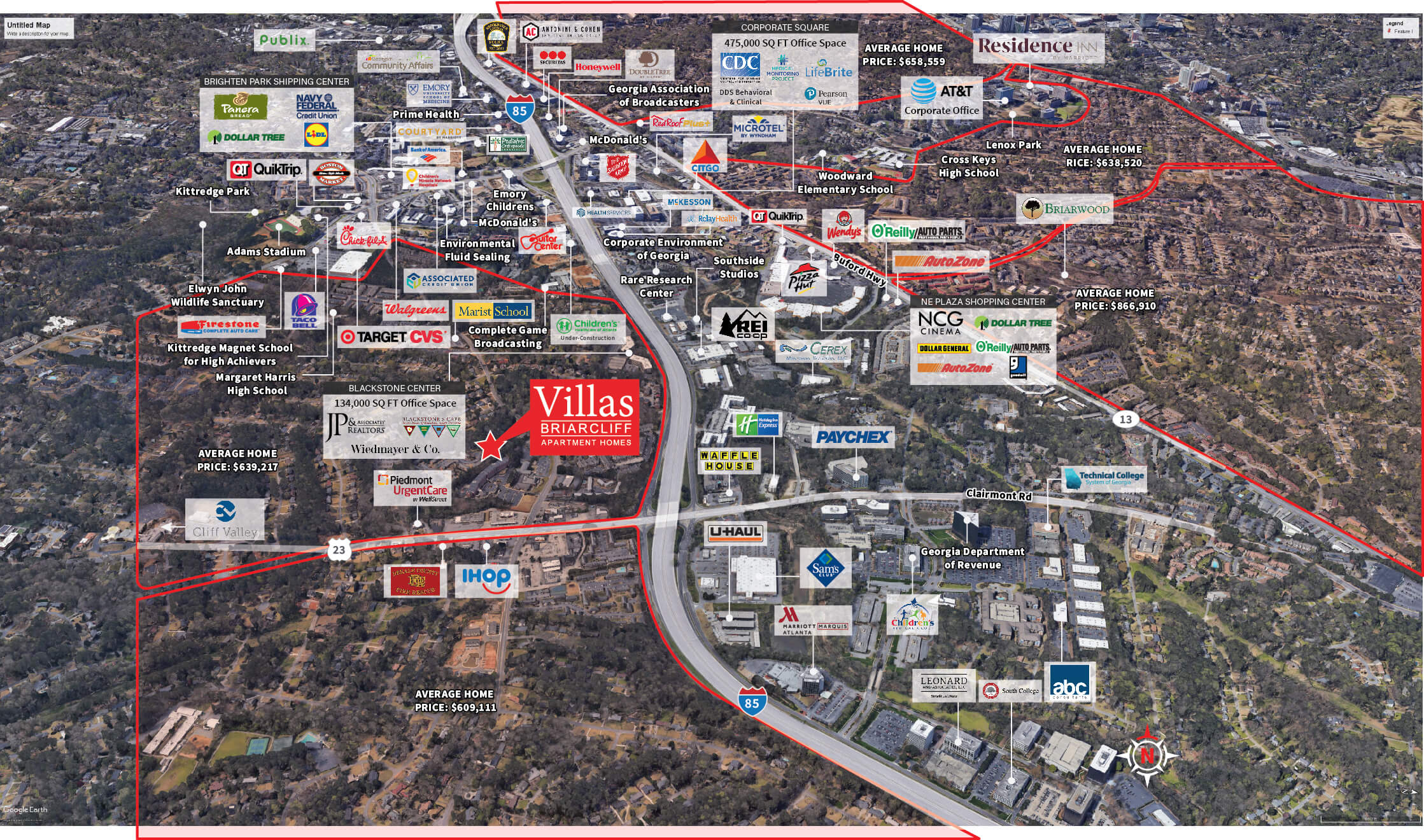
Aerial – Micro Villas at Briarcliff V3
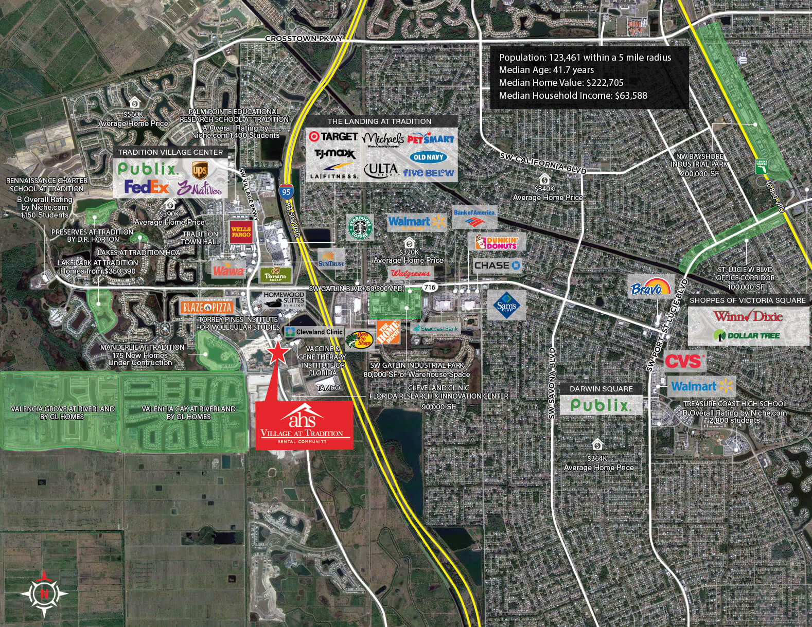
Aerial – The Parc at Gatlin Commons – Demand Driver NEW-01
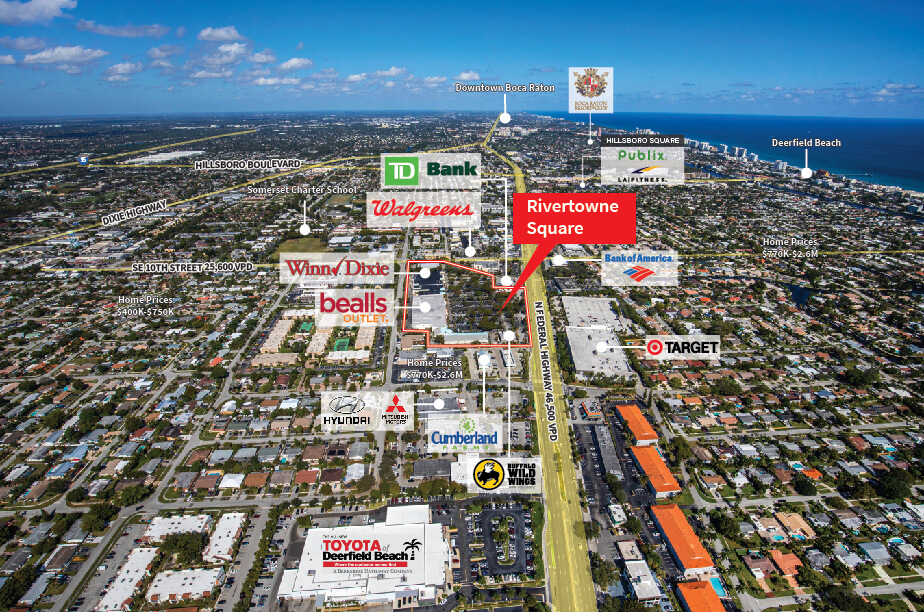
Rivertowne Square2
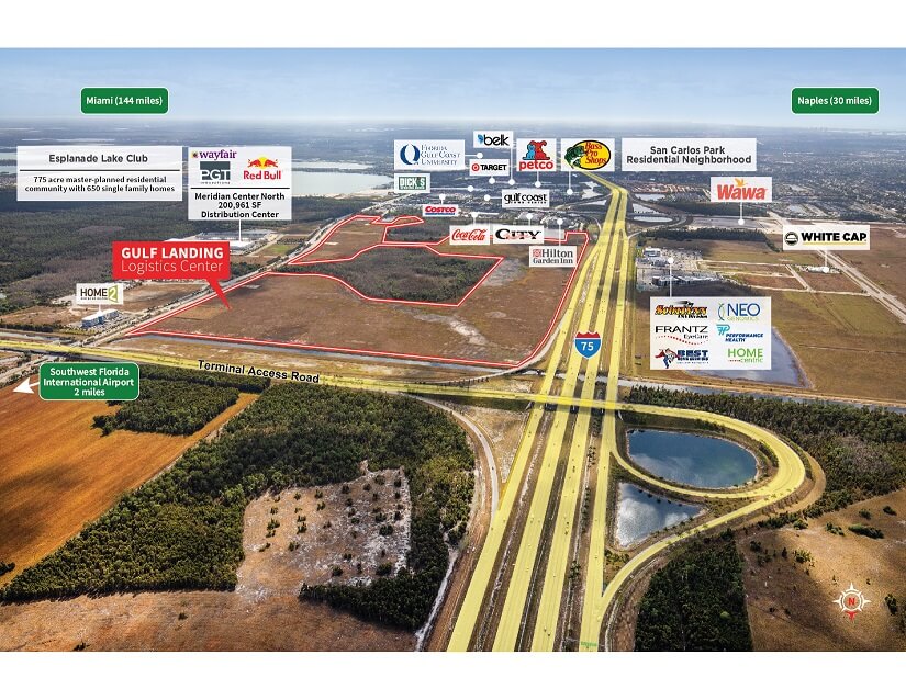
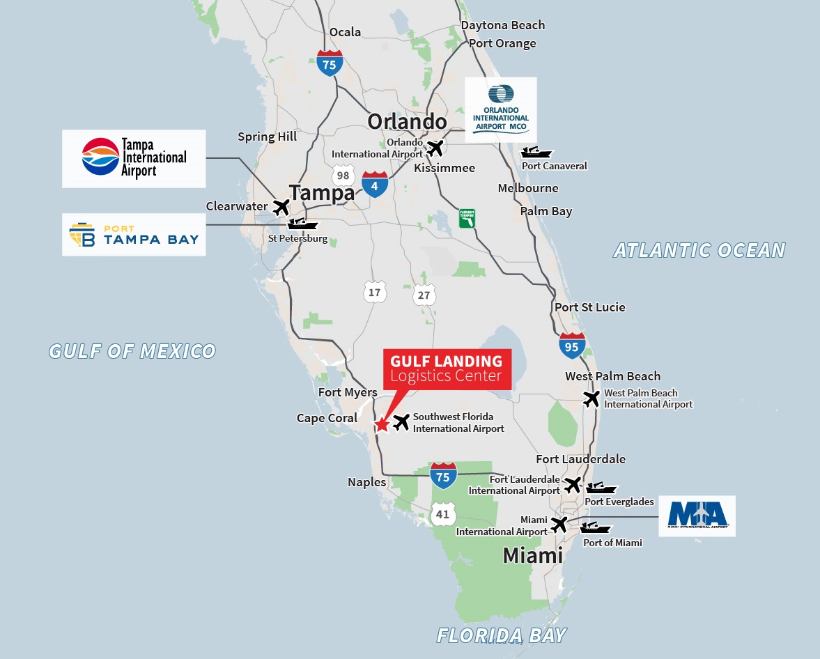
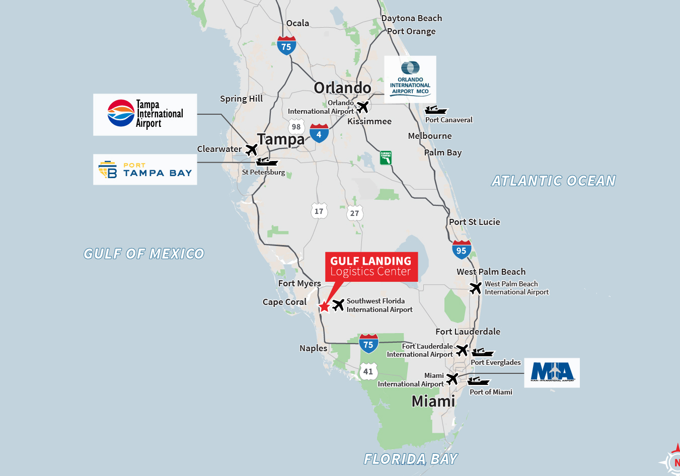
Gulf Landing Logistics Center – Aerial
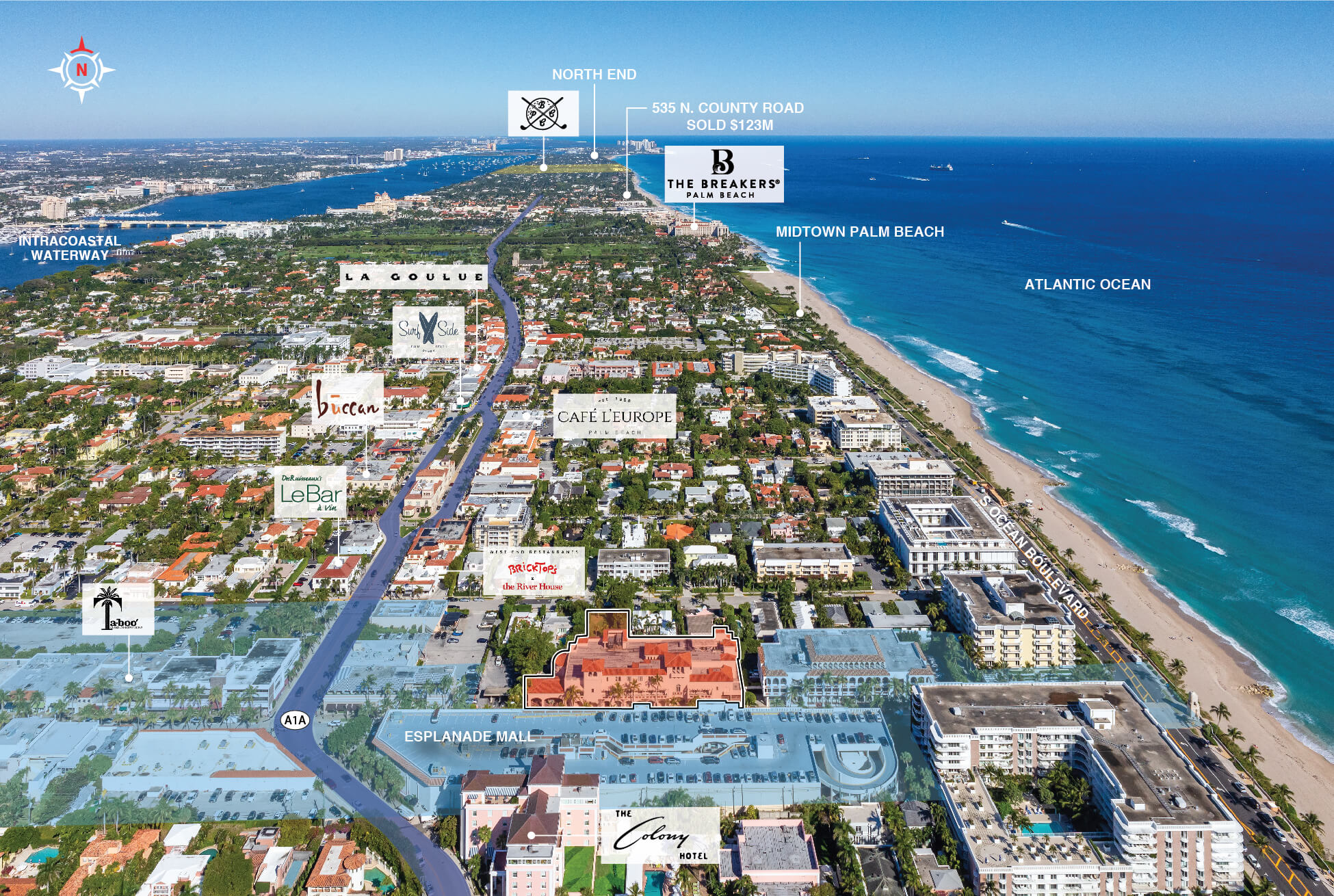
151 Worth Ave Palm Beach
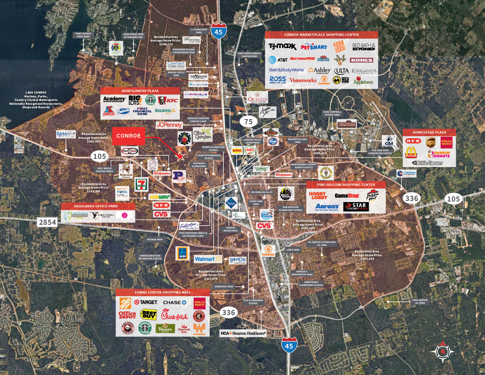
Conroe – Demand Driver Map
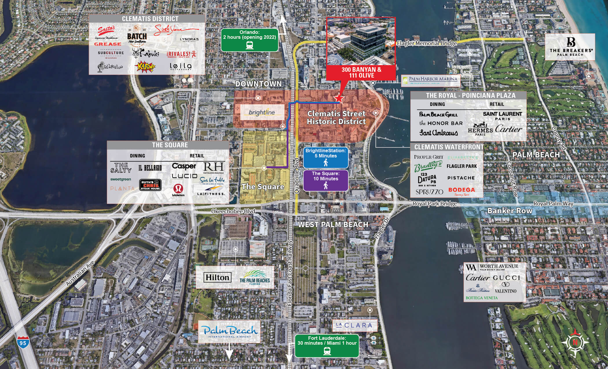
Downtown WPB Market

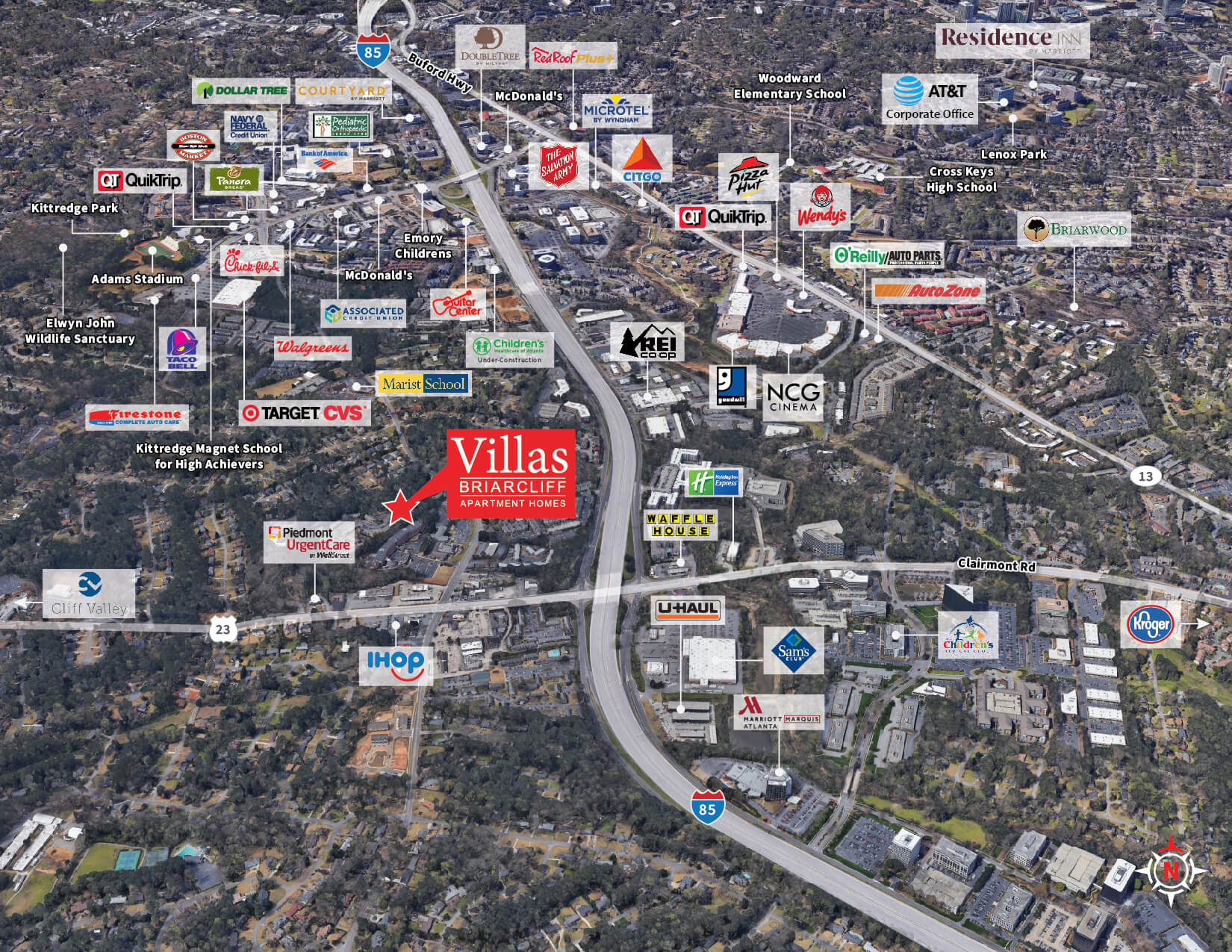
Villas at Briarcliff – Demand Dirver
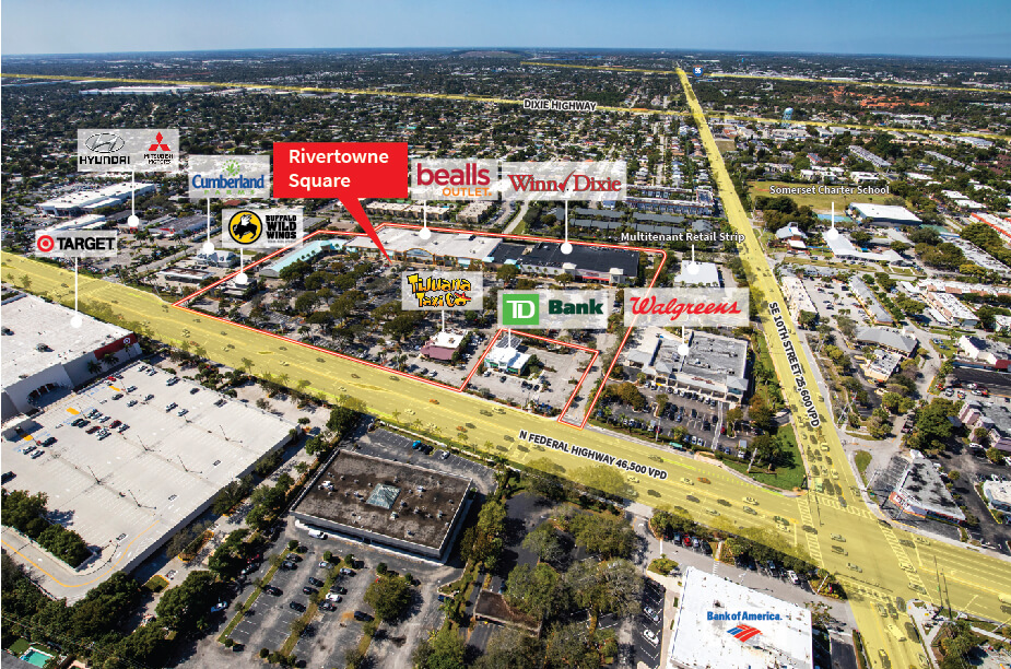
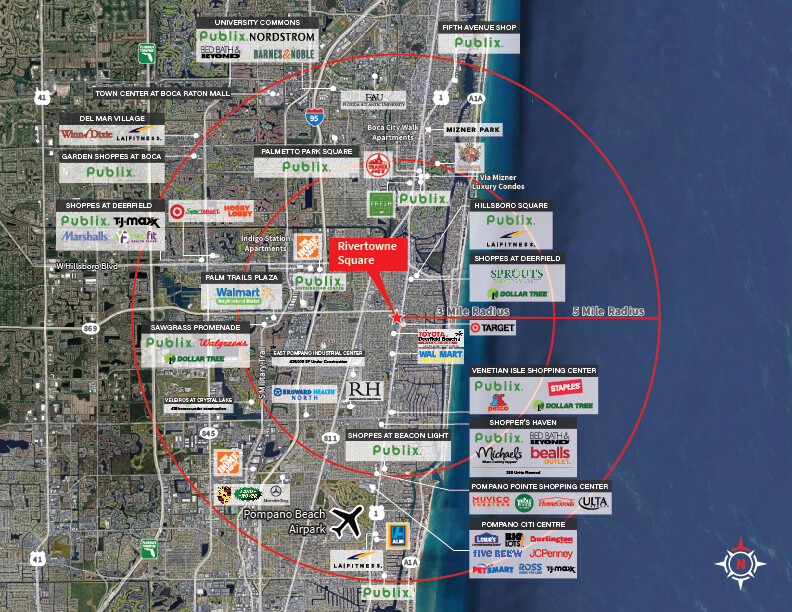
Rivertowne Square
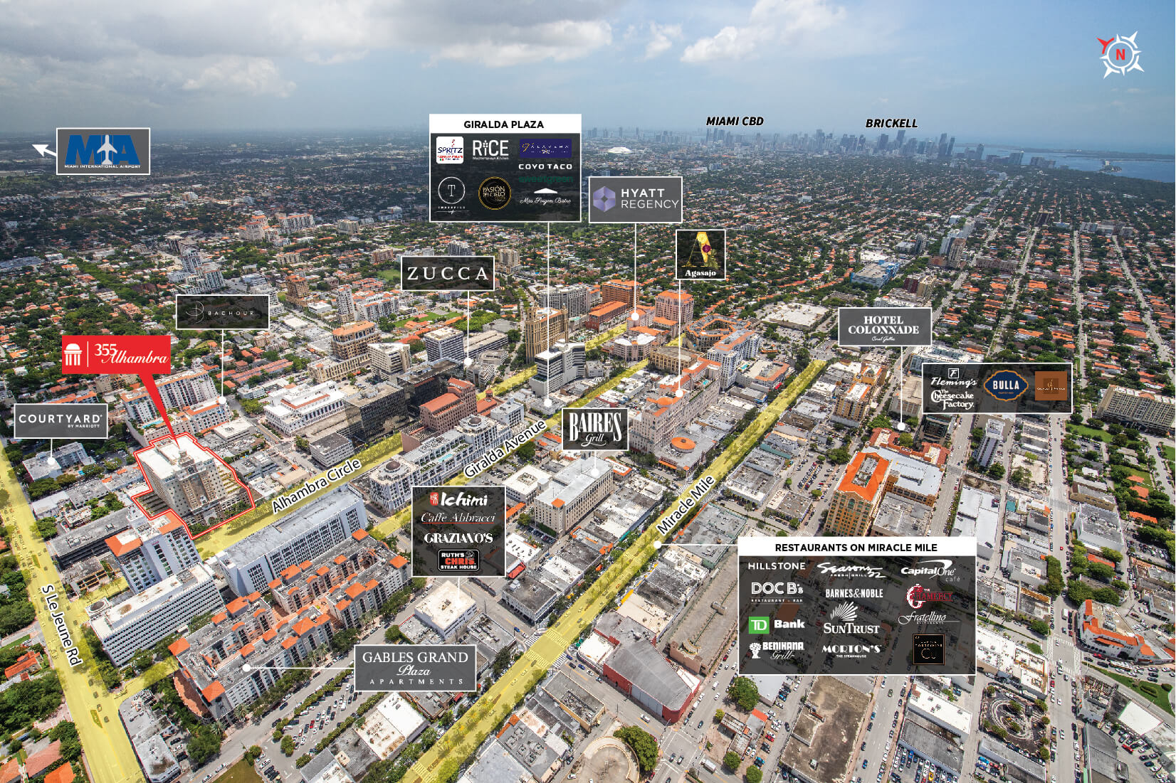
355 Alhambra Plaza
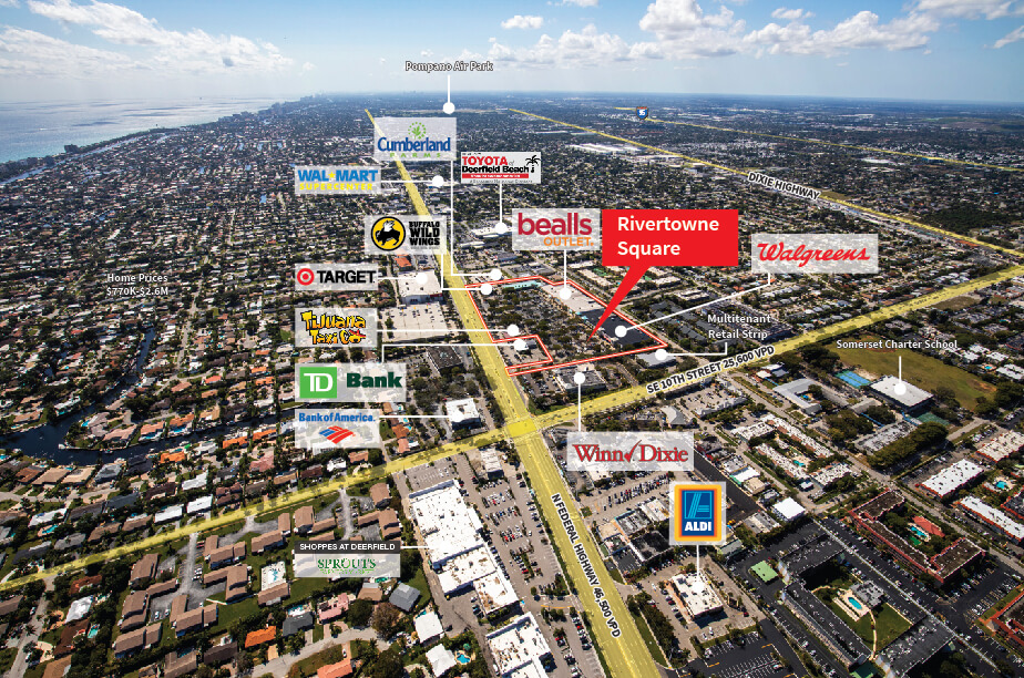
Rivertowne Square – Aerial
Housing
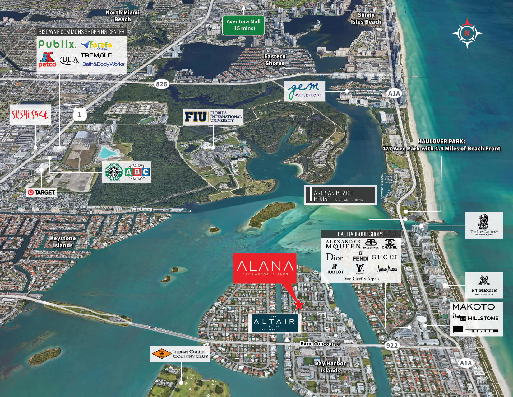
Alana Bay Harbor – Demand Driver Map-01
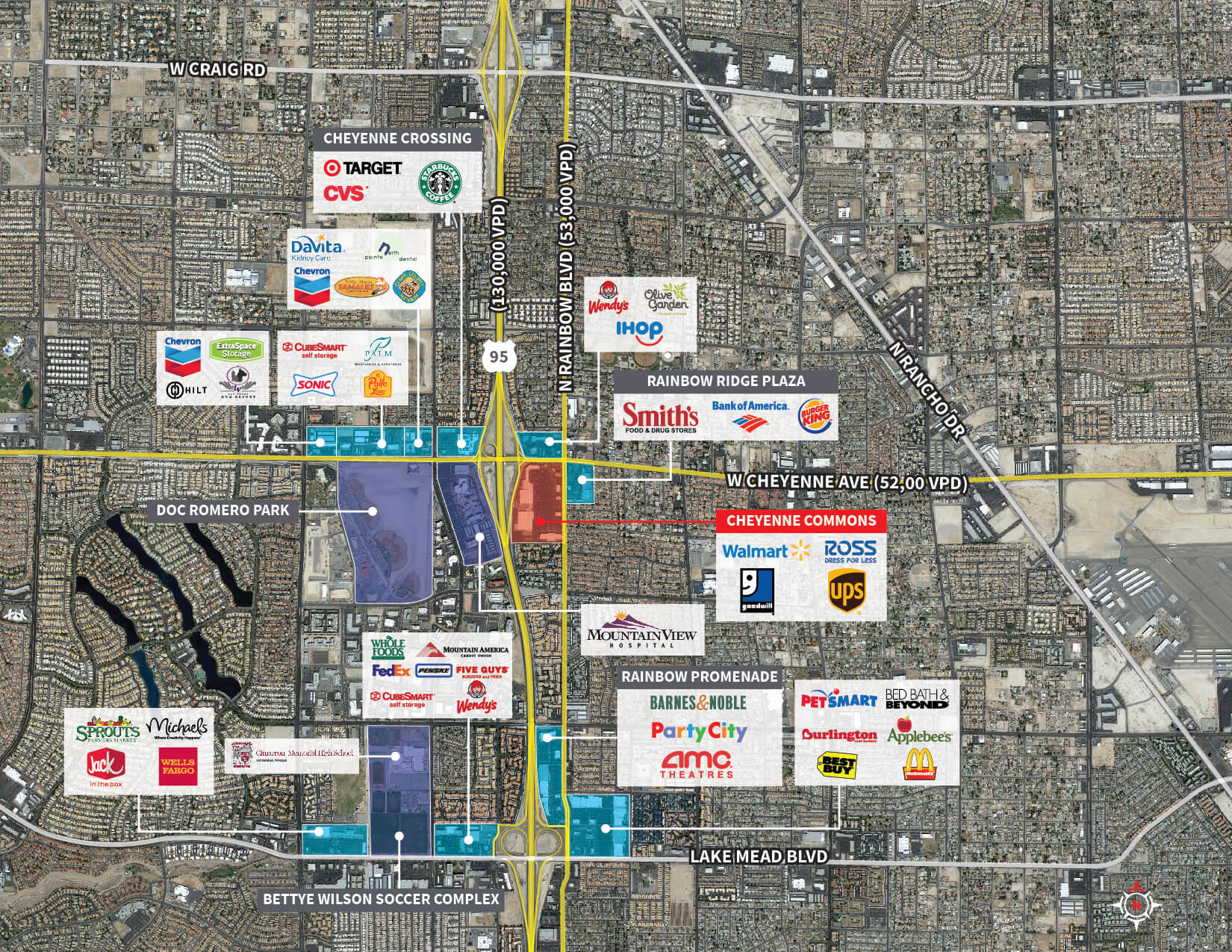
Cheyenne Commons – Aerial Retail Map
Butters Group – Google Trade Aerial-01
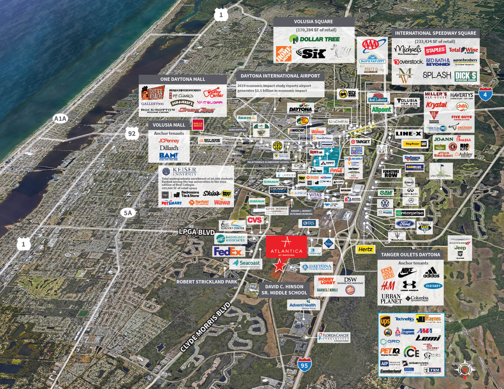
Atlantica Daytona Demand Driver-01
Aerial – Micro Villas at Briarcliff V2-01
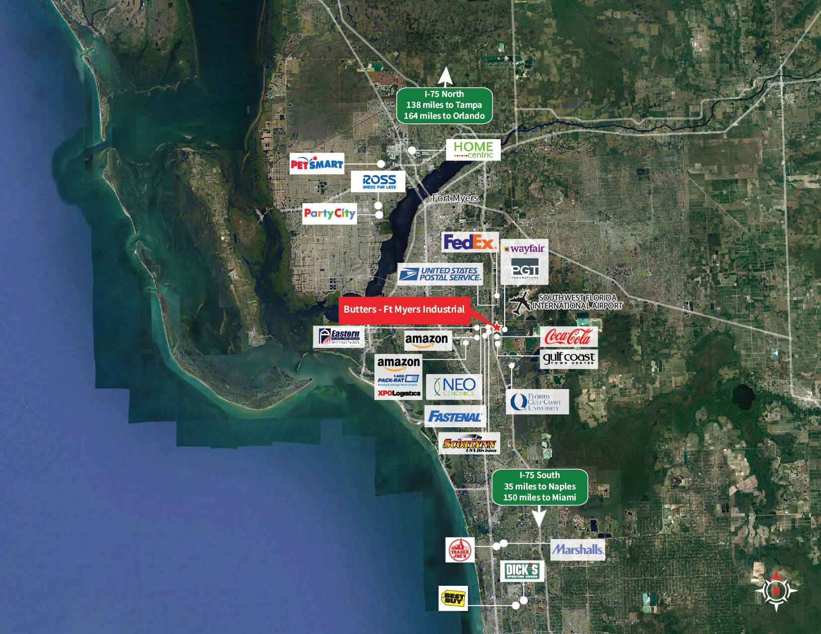
Butters – Ft Myers Industrial – Nearby Tenants-01
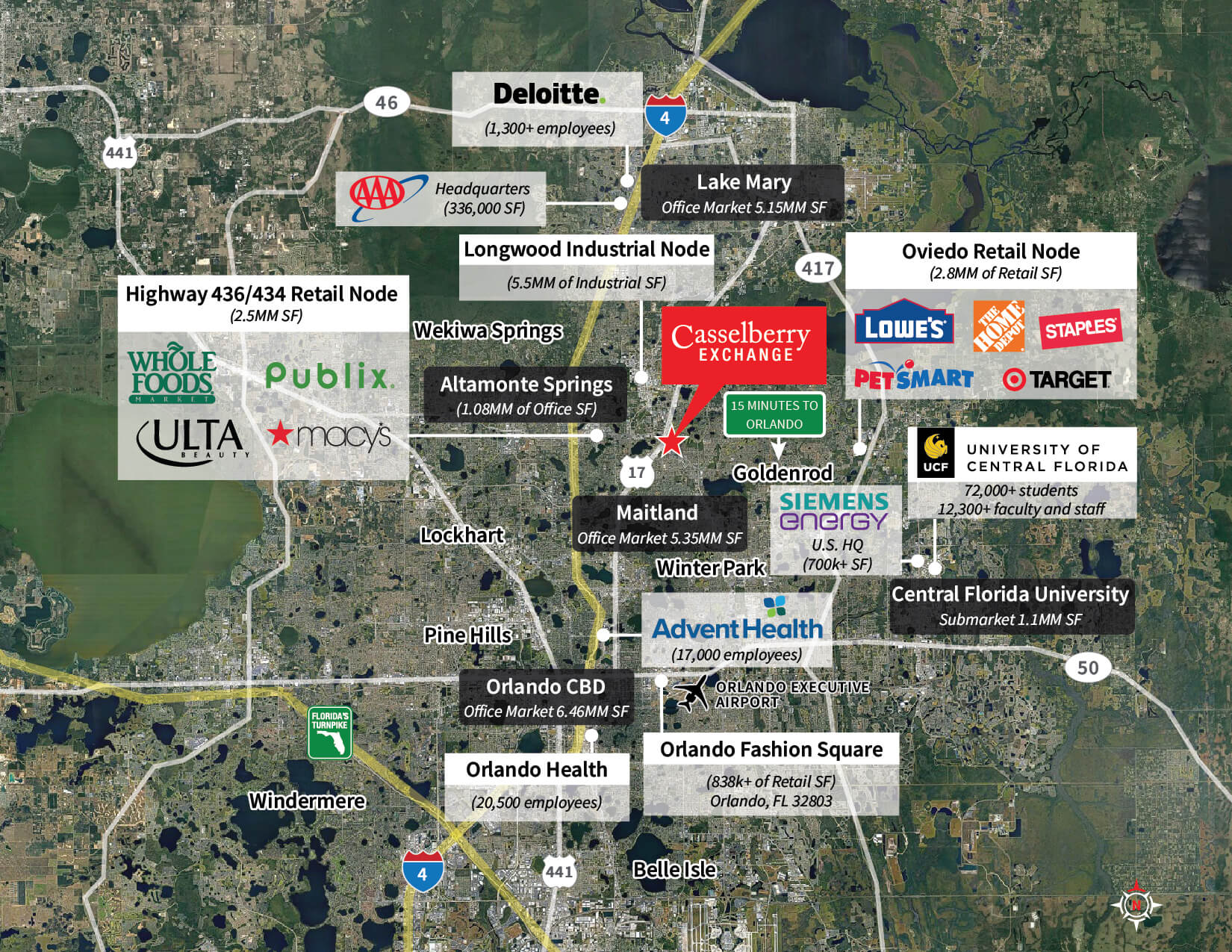
Casselberry Exchange – Trade Aerial-01
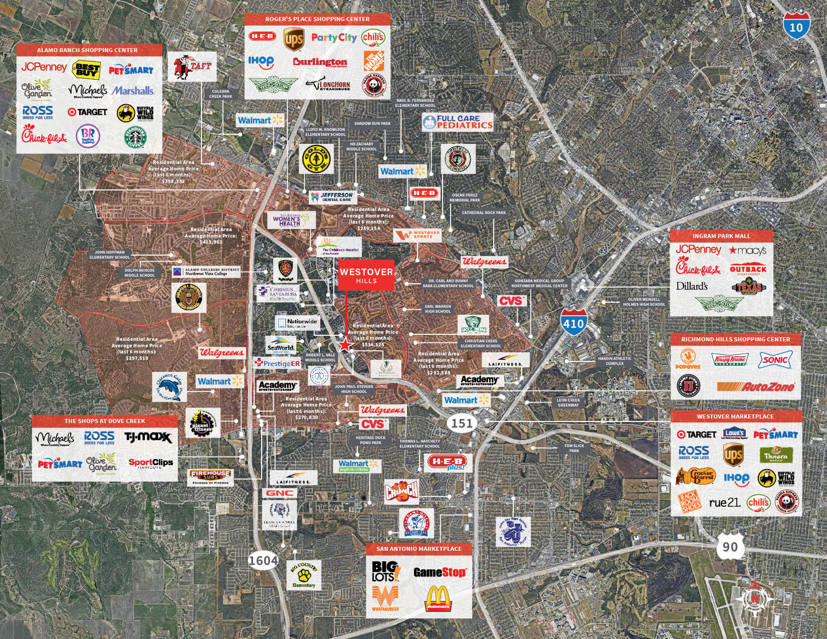
Westover Hills -Severeign Recap – Demand Driver
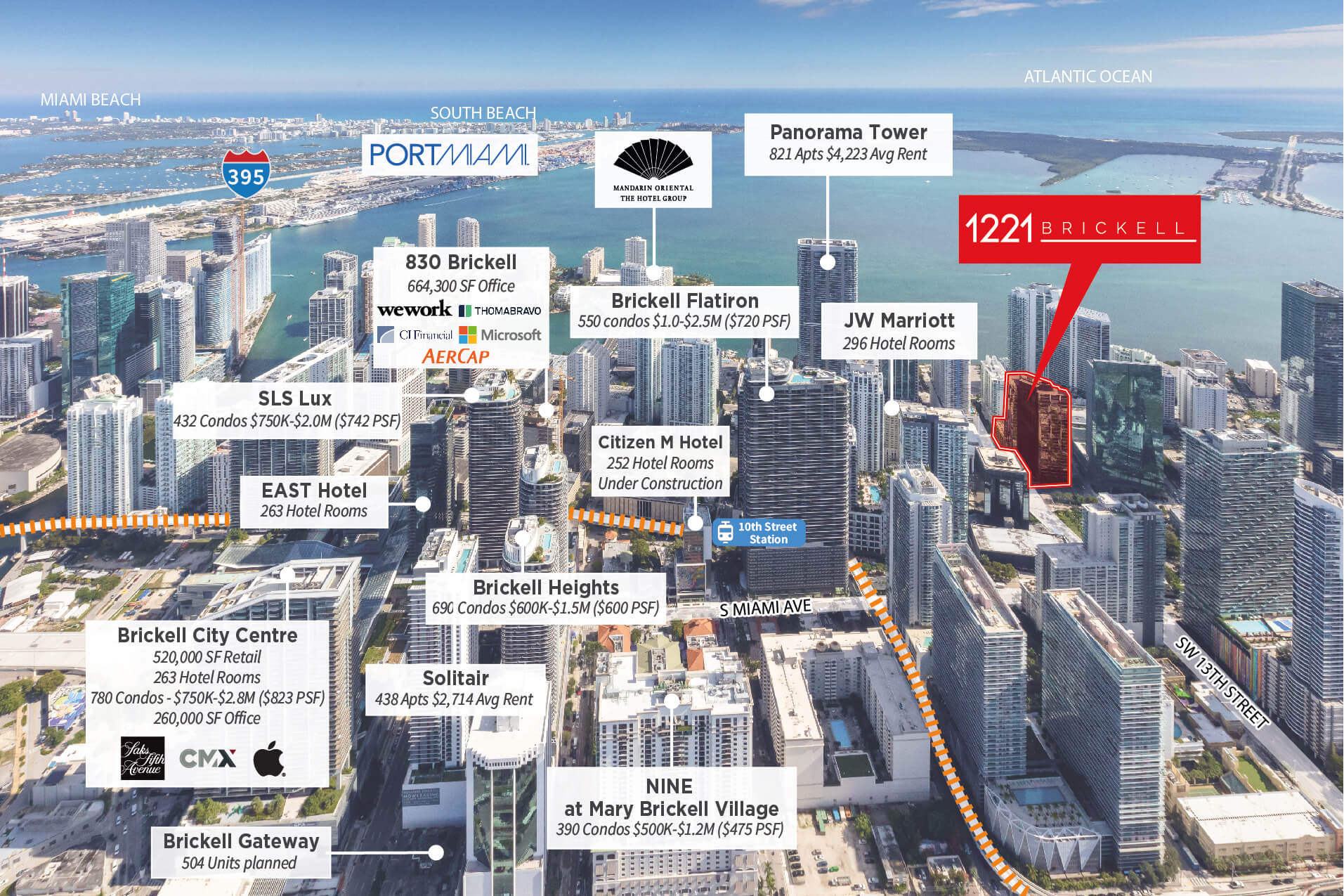
1221 Brickell
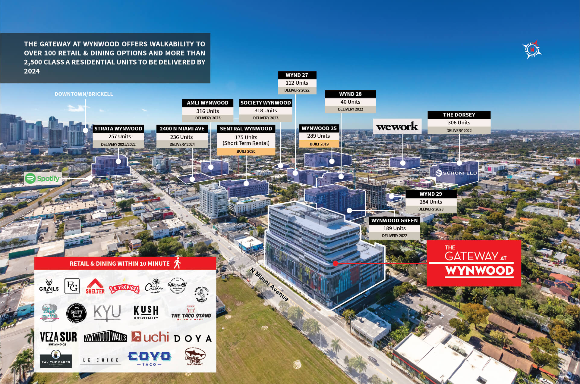
Gateway Wynwood – Aerial-01
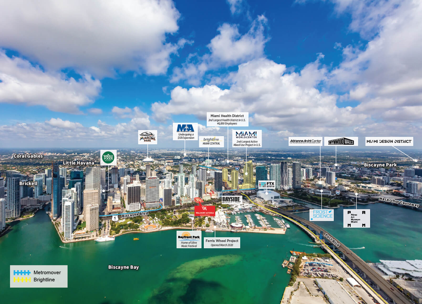
Waldorf Astoria – Miami
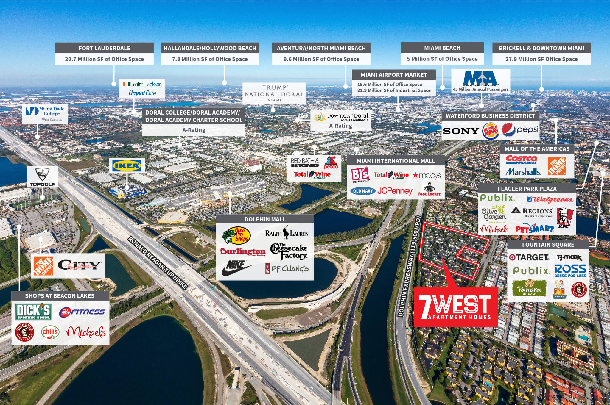
Aerial – 7 West Miami-SAMR2153-20220115-01
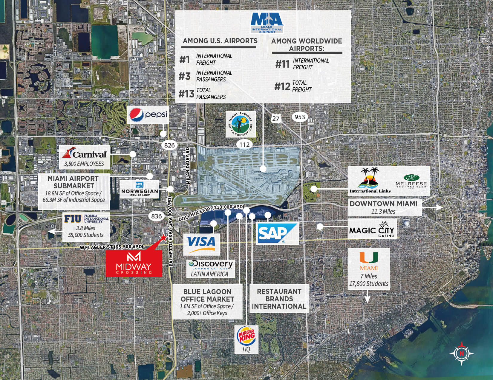
1 Aerial – Midway Crossing
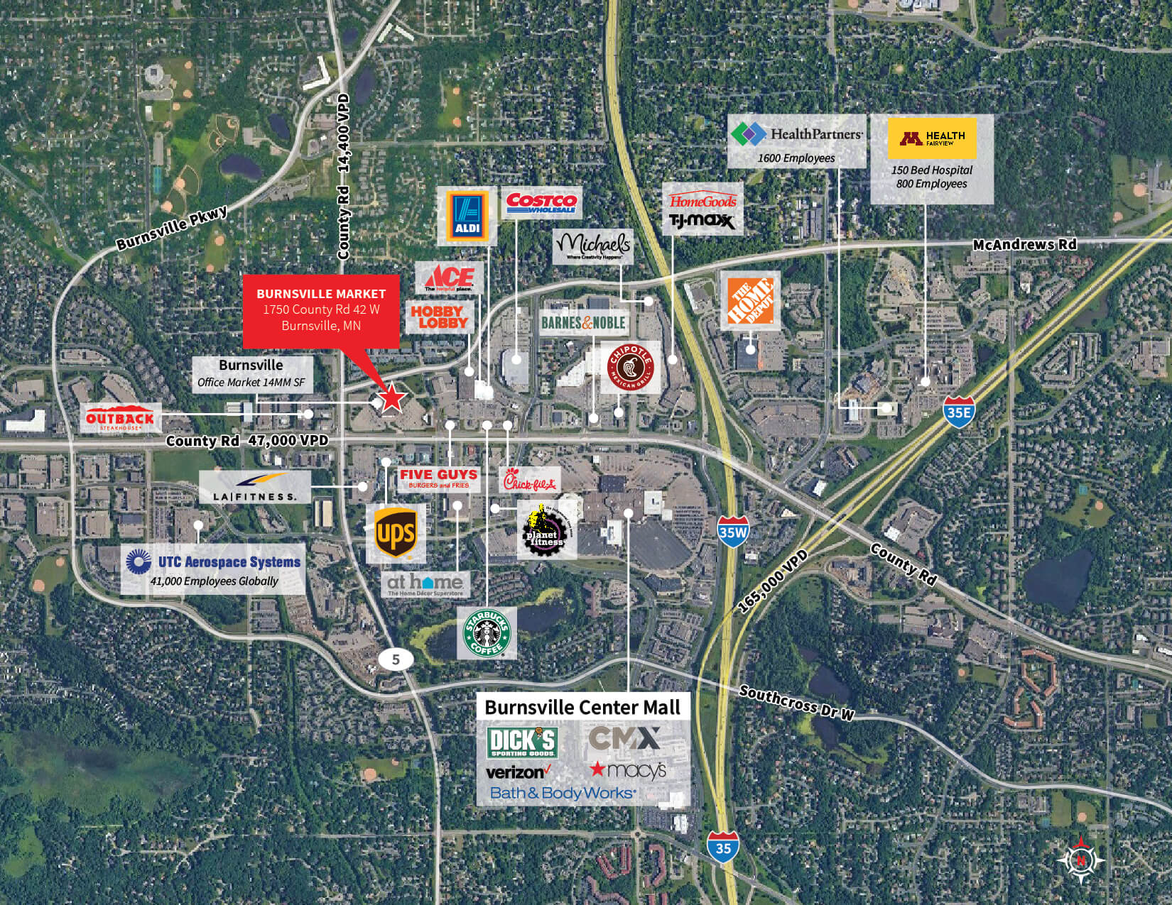
Burnsville Market – Demand Driver-01
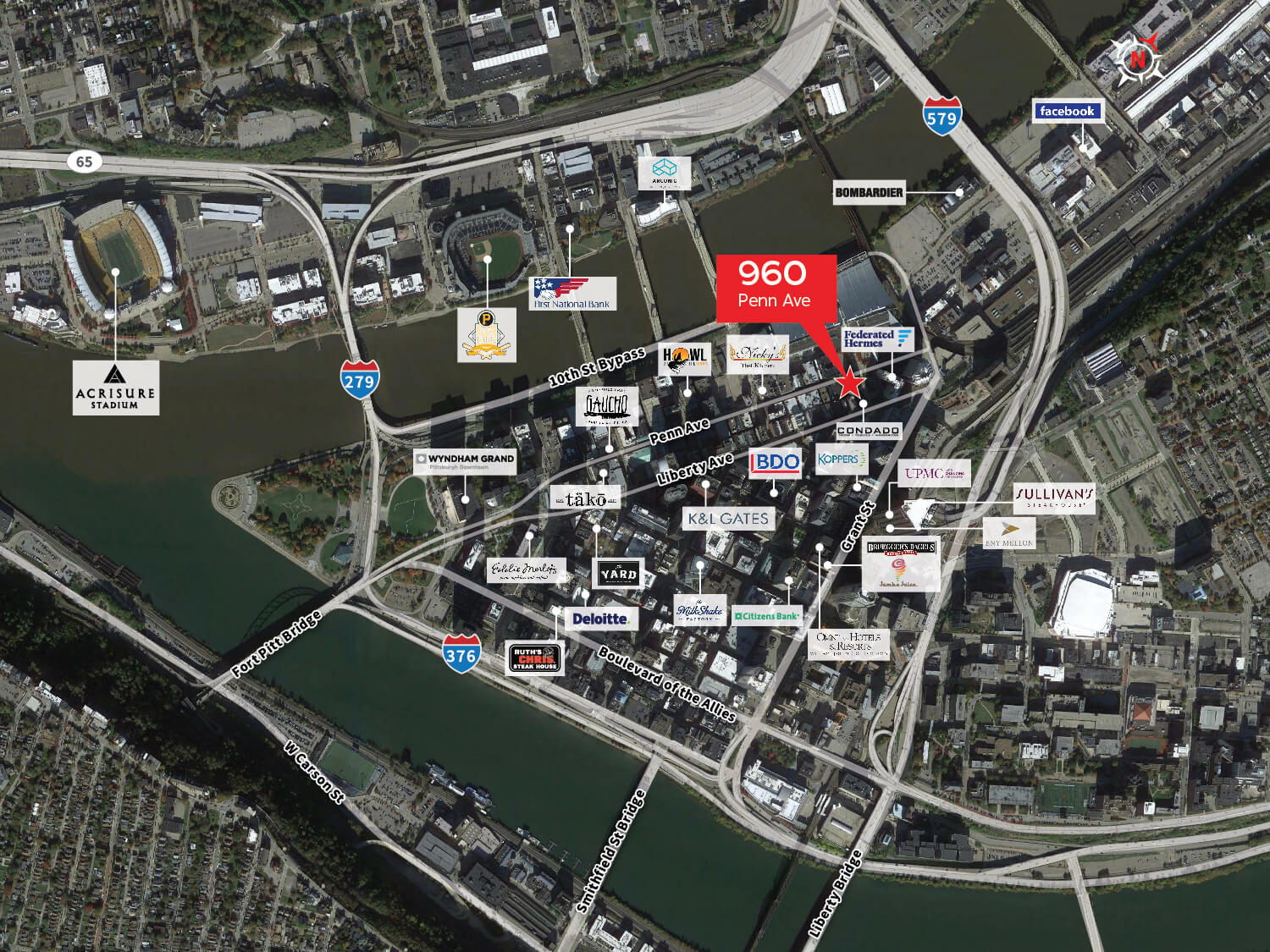
960 Penn Ave – Google Aerial

Wake Biscayne Bay – 1900 S Treasure Drive North Bay Village
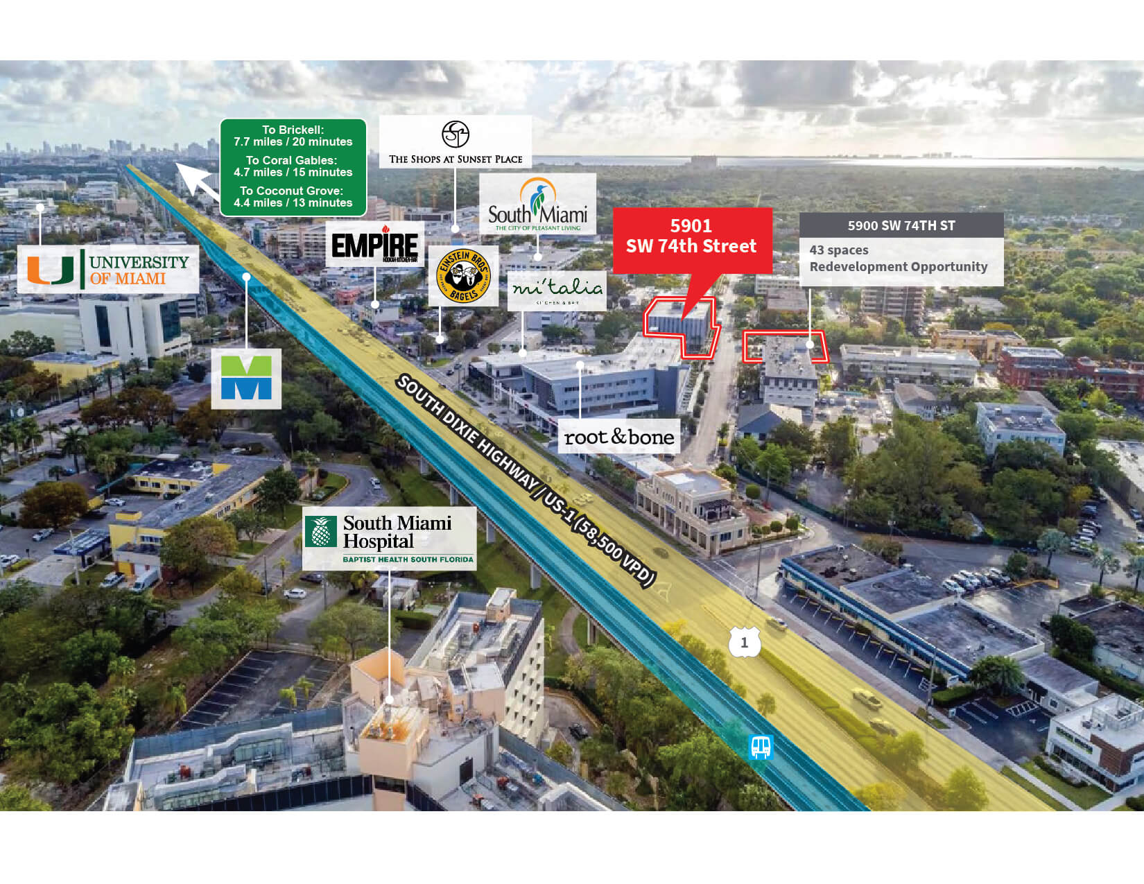
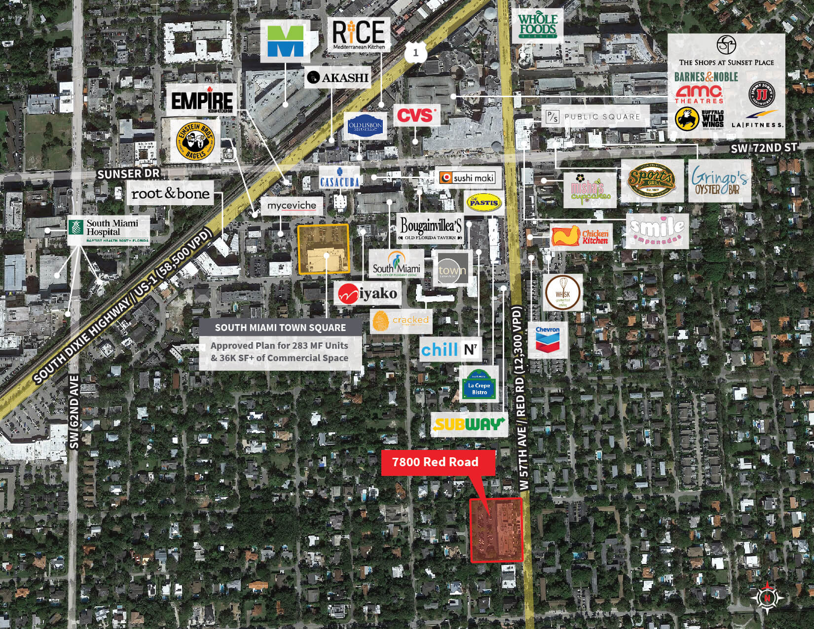
5901 sw 74th Street & 7800 Red Road
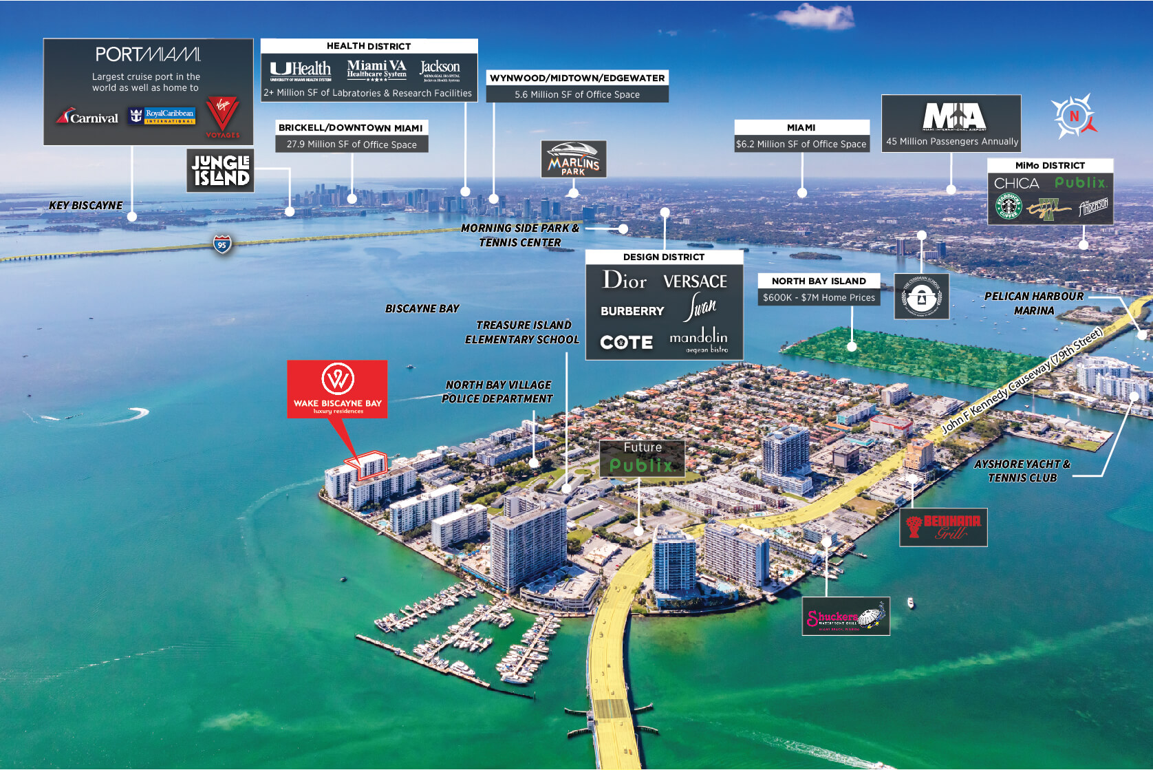
Wake Biscayne Bay – 1900 S Treasure Drive North Bay Village-SAMR4310-20220228-01
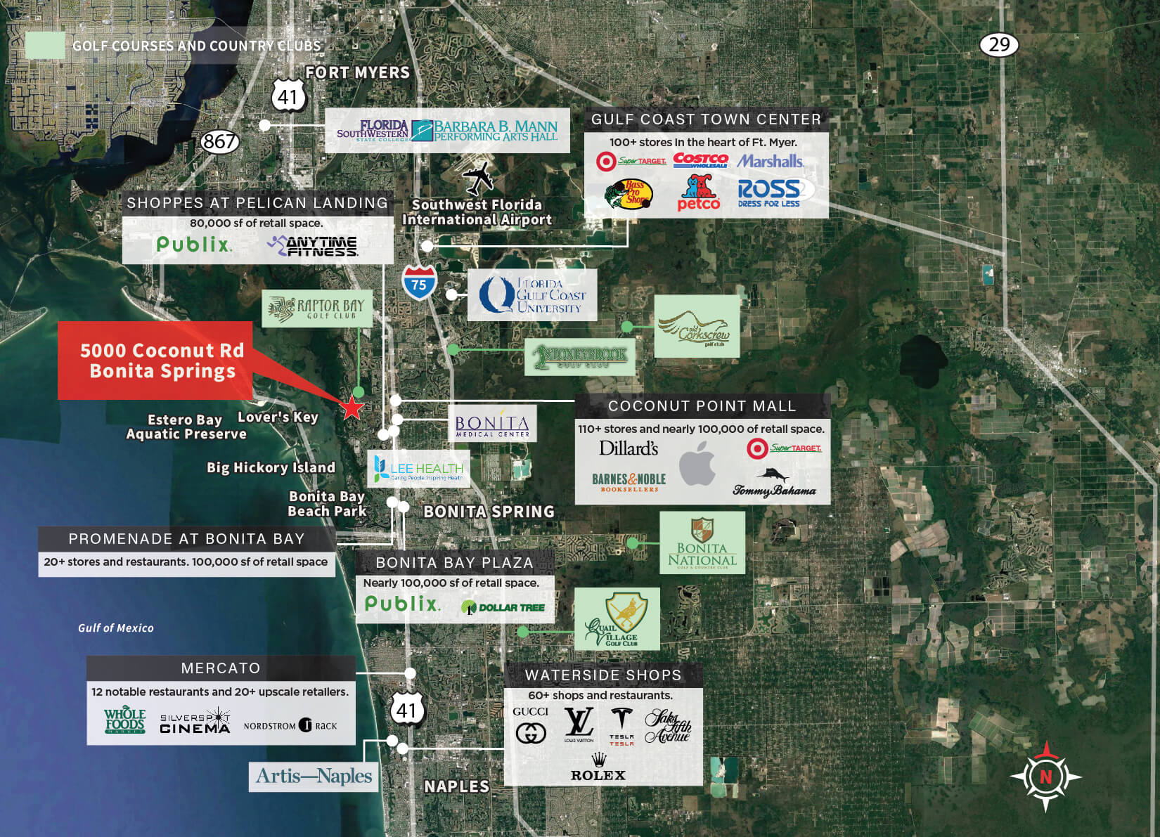
Ritz Carlton Estero Bay
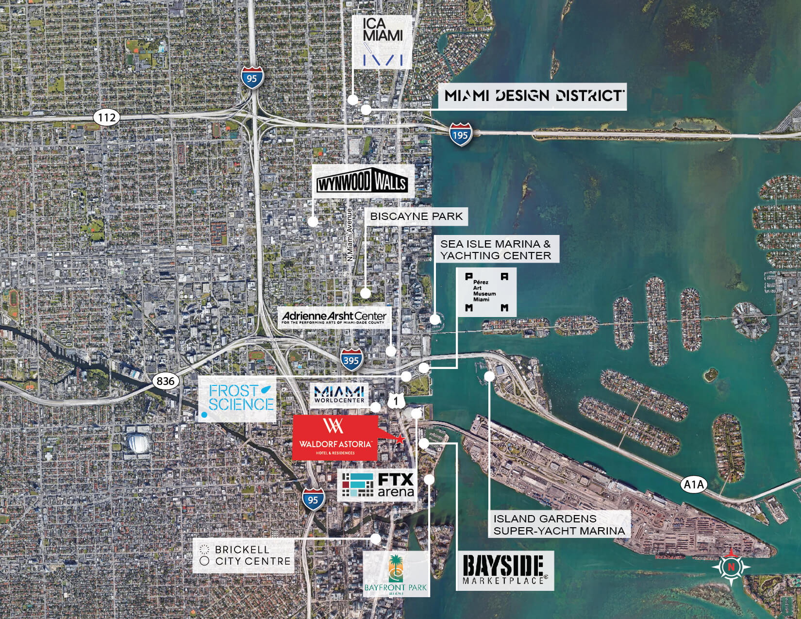
Waldorf Condo Development
7800 Red Road – Large Aerial Overview-01-017800 Red Road – Large Aerial Overview-01-01
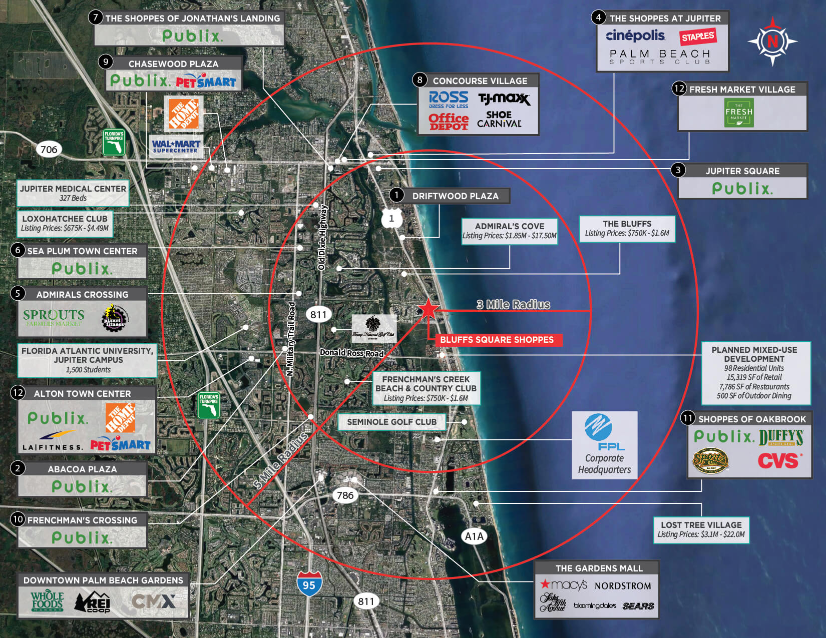
Bluffs Square Shoppes Trade Aerial-01
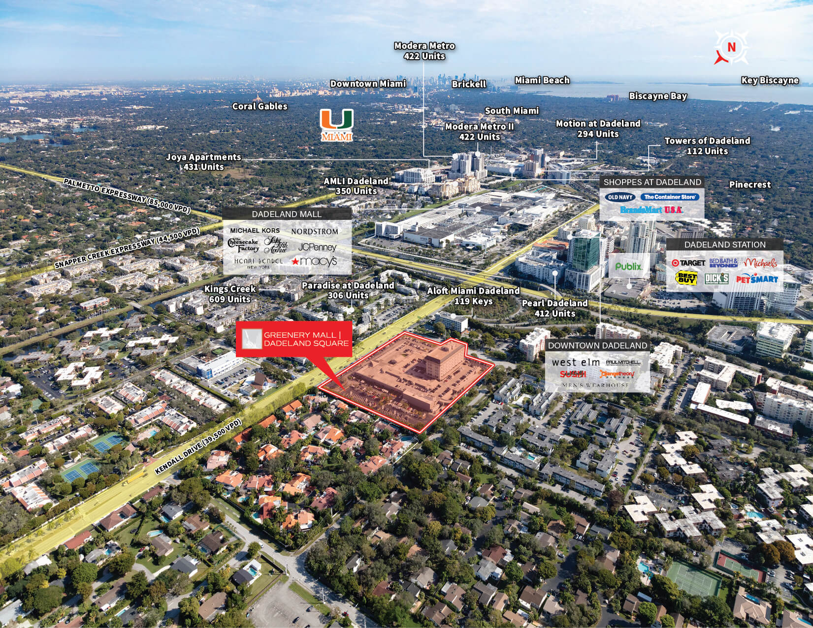
Greenery Mall – Labled
Large/Detailed Map
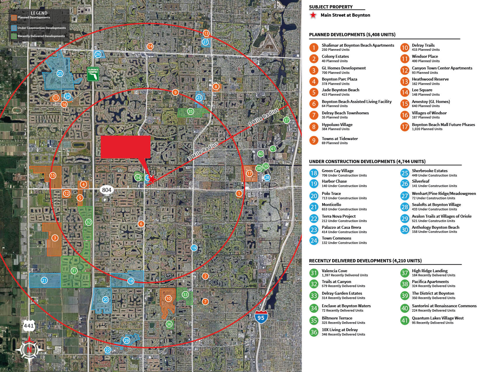
Main Street at Boynton – Residential_Mesa de trabajo 1

Gulf Landing Logistics Center – Aerial 3-01
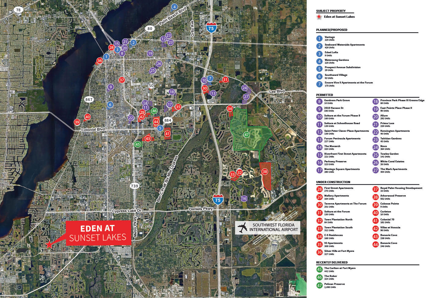
Residential Growth Corridor Google Aerial – Eden 3Pack-01

5901 sw 74th Street & 7800 Red Road – Regional Aerial 4-01
Ready to take the
next step?
in your real estate project?
Let’s connect!
Let’s chat! Text only:
+1 240 565 4873
[email protected]
We’re here Monday to Friday 8 AM – 6 PM, and Saturdays from 9 AM – 2 PM.